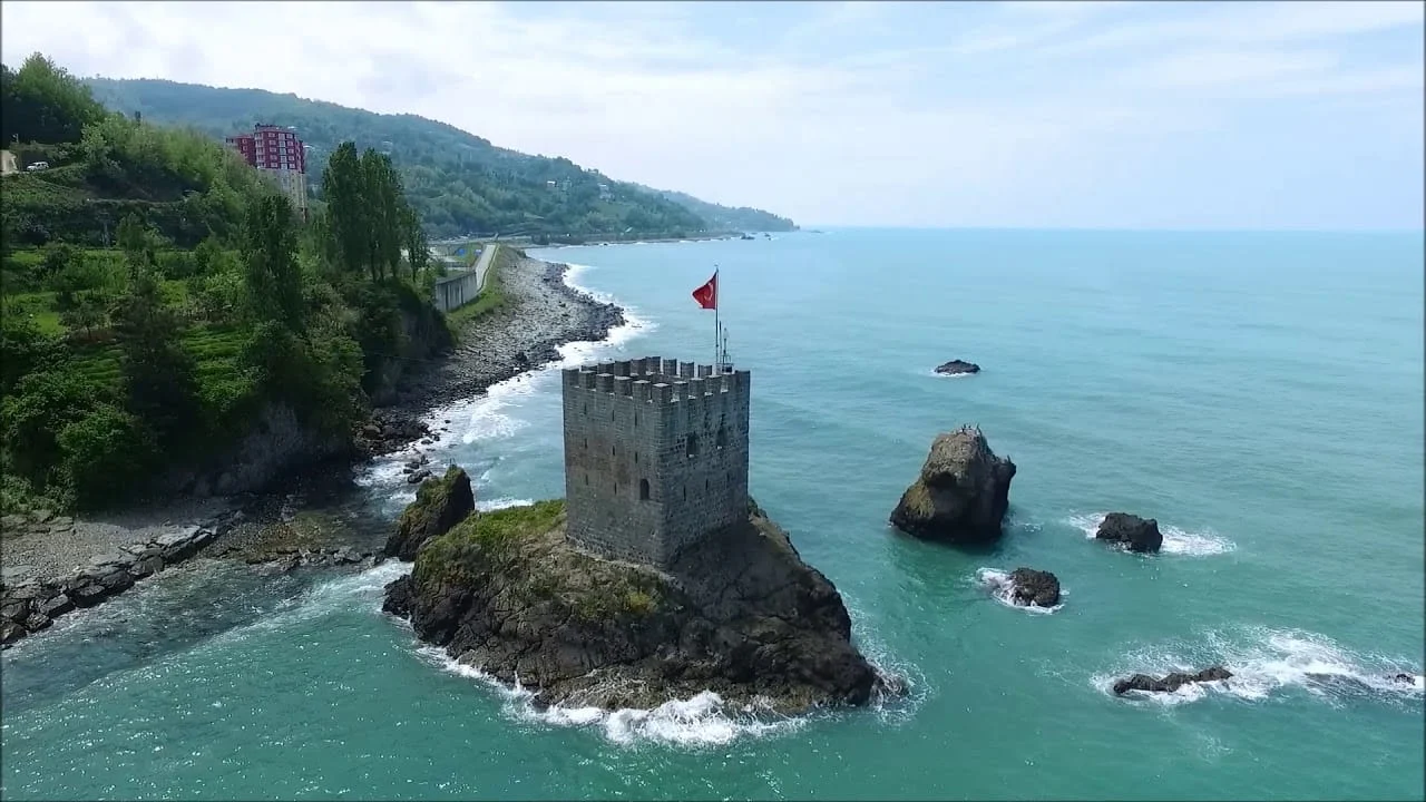
I left Bartın at 06:40 on a grey July morning, the sky doing that flat Black Sea thing where it isn’t quite raining but it isn’t quite not. Seventeen kilometres later the road bent over a ridge and dropped me into Amasra. Two harbours, an old fortress, a single mosque tower above the rooftops, and the sea — green, not blue, the way the Black Sea is always green here. I stopped at a teahouse by the small harbour and ordered a glass of çay and a fried-fish breakfast. The man at the next table asked where I was going. I said east. He laughed. “Yavaş git,” he said. Go slow.
That’s the only piece of advice you need for this coast.
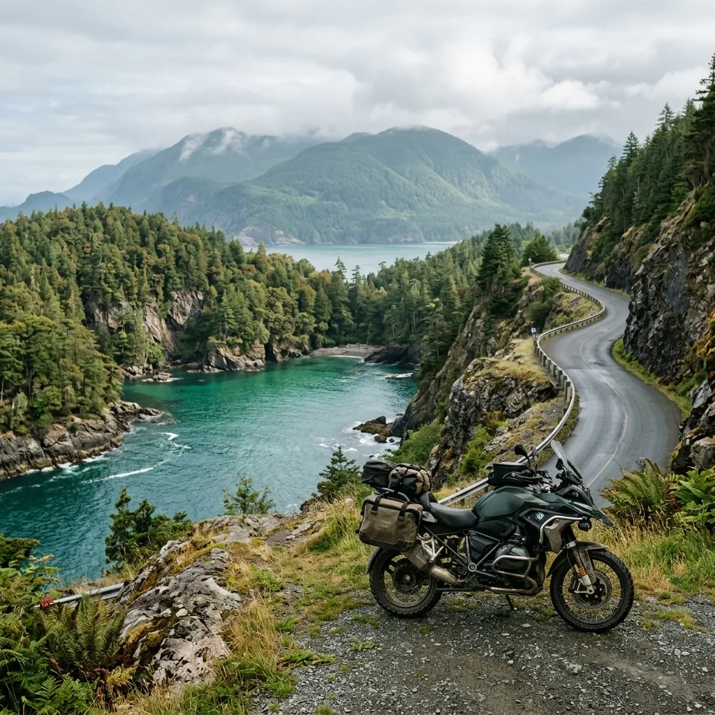
For three years on this blog I’ve written about the Mediterranean — the Lycian Way, the Datça coves, the Aegean wild-camp spots. Foreign riders find that coast easily. They land at Antalya, rent something, ride D-400, post photos of Kaputaş. Fine. But the Black Sea is the half of Turkey that doesn’t make it into English-language route guides, and the Kaçkar Mountains are barely on the map outside Turkish hiking forums. That gap is what this guide is for. Six riding days, roughly 1,150 km from Amasra to Yusufeli, ending at 3,000 metres on a gravel pass that no rental agency will tell you about.
This is the Black Sea counterpart to the Lycian Way motorcycle route guide. If the south coast is about turquoise water and ancient cities you can swim into, this one is about narrow cliff roads, wooden boat-building villages, hidden coves, and a high finale where the asphalt simply ends. Riders building a longer overland loop can stitch this stage into the full Turkey TET breakdown — the Kaçkar finale ahead actually overlaps a published Trans Euro Trail section.
Why the Black Sea Is Turkey’s Underwritten Coast
There are two reasons almost nobody outside Turkey writes about this route in English.
The first is that the Black Sea doesn’t look like a postcard. The water is green, not turquoise. The sky is overcast more days than it isn’t. The villages are tin-roofed and working, not whitewashed and curated. None of this photographs well on Instagram, and that is precisely why the coast has stayed itself.
The second is the road. The D010 from Amasra east is a narrow, continuously winding strip of asphalt cut into cliffs above the sea — sometimes 100 metres up, sometimes at the waterline. Average speed is low. There’s no point trying to cover ground here. Big tourers with hard luggage struggle on some of the tighter sections. Mass tourism never came because the road was never wide enough to bring it in. The whole coast was saved by its geometry.
That’s the deal: you trade the south coast’s heat, prices and crowds for green, cool, cheap, and almost empty. In July and August, when Antalya is 40°C and the bays are full, Cide is 26°C and you can pitch a tent on a beach and have it to yourself.
If you’ve already read the wild camping in Turkey guide, this route is the bay-night version of that article. The legal grey area I described there applies the whole way along this coast, with the usual exceptions for military zones and ancient sites.
The Route at a Glance
| Day | Stage | Distance | Highlight |
|---|---|---|---|
| 1 | Amasra → Cide | ~90 km | Slow coast, wooden boats, Gideros |
| 2 | Cide → Sinop | ~280 km | Northernmost point of Turkey |
| 3 | Sinop → Ordu | ~330 km | The long distance-covering day |
| 4 | Ordu → Trabzon (via Giresun) | ~180 km | Greener, wetter, the eastern Black Sea proper |
| 5 | Trabzon → Ayder Yaylası | ~170 km | The climb off the sea into the high country |
| 6 | Ayder → Yusufeli (Trans-Kaçkar) | ~110 km | Gravel, 3,000 m pass, the Çoruh valley |
Total: about 1,150 km, spread very unevenly. Day 1 is intentionally short because the road forces it. Days 2 and 3 cover real distance. Days 5 and 6 are short on the map and long in the saddle because of the climb and the gravel.
Day 1: Amasra to Cide — The Slow Coast (~90 km)
I’m going to give this day the space it deserves, because Day 1 is the day that decides whether you “get” this coast or not. It’s only 90 km. It is a full day of riding. If you try to do it in two hours you will hate it. If you give it a day, with stops, swims, lunches and a slow drift between villages, it is the best single day of slow riding I know in Turkey.
Bartın → Amasra (~17 km warm-up)
I live in Bartın. The 17 km down to the coast is my warm-up loop, and a good place to settle into the bike before the road narrows. Bartın itself is a quiet small city with a few decent breakfast places near the river. There’s a Shell on the way out — fill up here if you didn’t fill up the night before. After Amasra, fuel becomes a thing you have to plan.
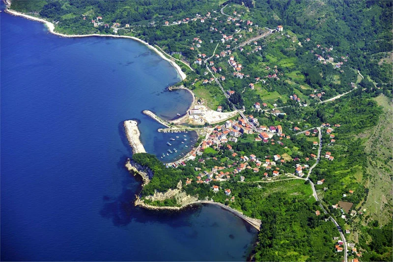
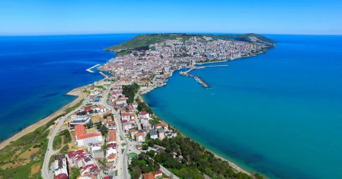
Amasra
Amasra is the set-piece opening of this trip and it has earned its place. A small fortress town built on a peninsula, with two harbours — locals call them Büyük Liman (Big Harbour) and Küçük Liman (Small Harbour) — and a small offshore island, Boztepe, known to everyone as Tavşan Adası (Rabbit Island), joined to the mainland by an old stone bridge you can walk.
The ancient name was Sesamos, in the historic region of Paphlagonia. Walls and gates from Roman, Byzantine and Genoese periods are woven into the modern town — you’ll be eating a kebab and notice you’re sitting next to a 1,500-year-old wall. Locals tell stories that link the area to the Amazon legends; treat that as exactly what it is, local lore, not history.
What Amasra is actually known for today is grilled fish and Amasra salatası — a chopped salad with something like twenty vegetables in it, served as a starter at every fish restaurant on the small harbour. Order it. Eat the fish. This is the last easy fuel stop, the last easy ATM, the last easy bike shop, and the last large grocery before the road thins. Stock up.
I usually leave Amasra around 10:00 with a full tank, a 2-litre water bottle bungeed to the rack and a sandwich in the tank bag.
Çakraz
Çakraz sits just east of Amasra, where the road first starts to feel like a coast road instead of a town exit. The ancient name was Erythinoi. There’s a small popular beach and the access to nearby Çambu beach, which is a good first swim if it’s warm enough. On weekdays in July it’s quiet. On weekends in August the locals come from Bartın, and it has the warm low-key feel of a beach where everyone knows everyone.
Akkonak
A small cove a few kilometres on. Day-trippers from Bartın in summer, almost empty mid-week. The kind of pull-off where you stop because you can. I usually have a coffee at one of the kiosks and check the tyres.
Göçkün
Tiny. Not on any English-language map I’ve seen. A small bay with flat stones, a couple of trees for shade, and that’s it. The road climbs sharply after Göçkün — first gear corners on the way out.
Karaman
Another small cove on the same stretch. Forest comes right down to the road. There’s a wooden tea garden — at least there was — on a bend above the bay. Stop and look back the way you came; the view back along the cliffs toward Amasra is one of the better photos you’ll take.
Hisarköy / Tekkeönü (Ovatekkeönü)
Here the coast starts telling you what it does for a living. Hisarköy and Tekkeönü are working fishing settlements, and Tekkeönü is one of the wooden boat-building villages that define this section of coast. You’ll see boat sheds open onto the water with half-built hulls in them, smelling of pine resin and wood shavings. This is a craft that did not die.
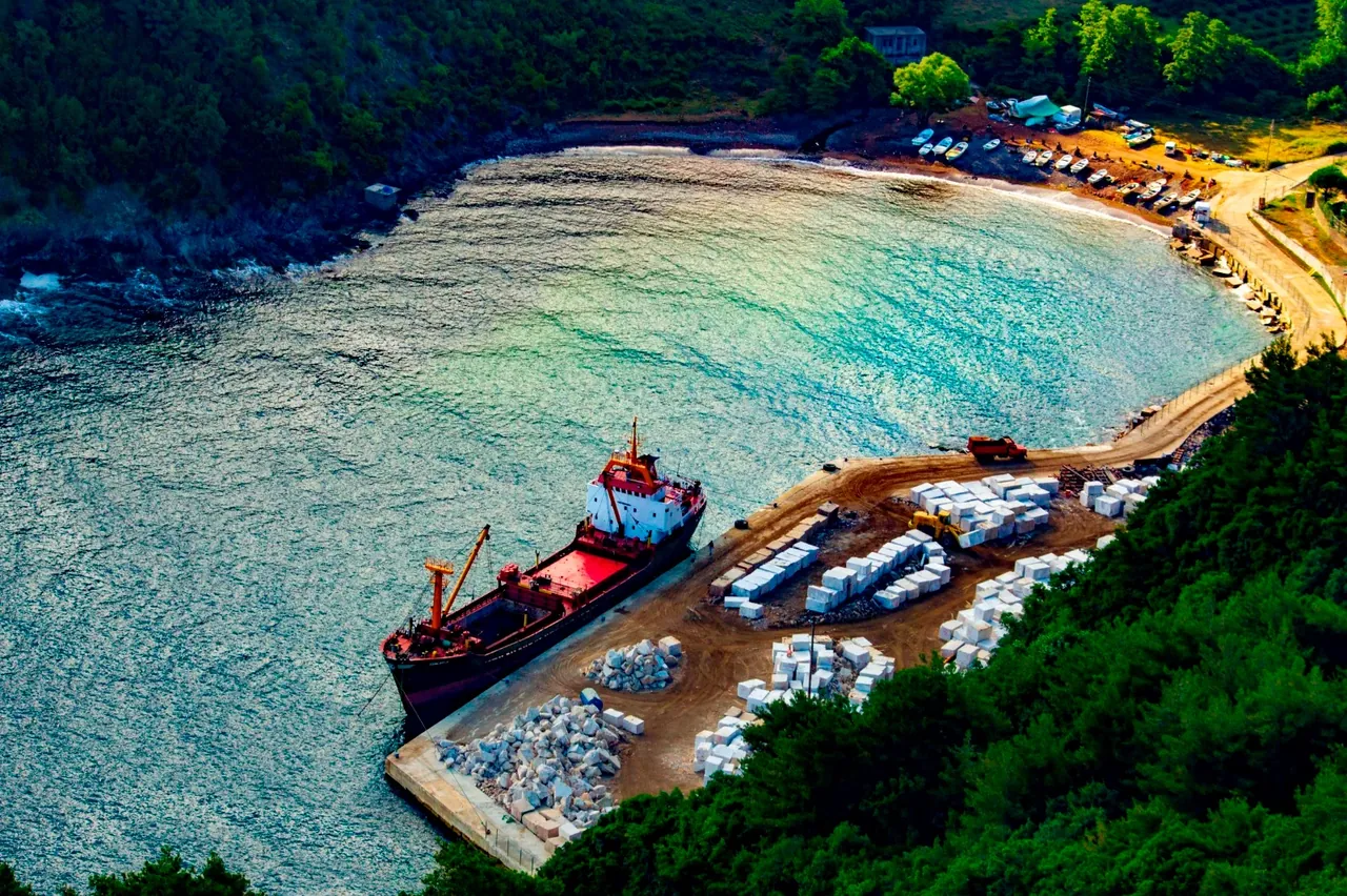
Kurucaşile
Kurucaşile is the heart of the wooden boat-building tradition on the Black Sea, and the cultural anchor of Day 1. The ancient name was Kromna. Wooden boat and yacht building here goes back something like four hundred years — locals will tell you fifteenth century, and the boats supplied parts of the Ottoman navy. The boatyards still operate today in open sheds along the waterfront, where you can stand in the road and watch men plane curved planks by eye.
There’s a vocational school in town, opened in the late 1990s, that exists specifically to keep the craft alive. That’s the kind of detail that tells you what the place thinks of itself.
The narrow, winding road in and out of Kurucaşile is what kept tourism off this coast, which is exactly why the town is still itself. The beaches around Kurucaşile are as good as anything west of Amasra. The crowds aren’t.
I usually stop here for a second tea and a wander along the harbour. There’s no pressure to keep moving; you’re not going far today.
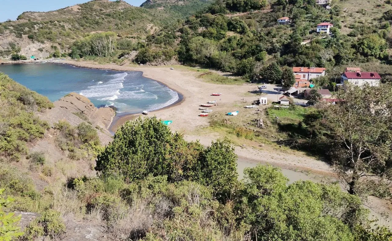
Kapısuyu
Another harbour village, another generation of wooden boat builders, a small beach with shade and a few pension signs. A natural lunch or swim stop if you didn’t eat in Kurucaşile. The river mouth is good for a cold-water face-wash.
Yenice
Small coastal locality. A waypoint more than a destination. There’s usually somewhere to buy a cold water and a sandwich.
Irmakköy
River-mouth village. Flat ground, shade, and — if you needed to wild-camp on this section instead of pushing to Gideros — this is the kind of low-key spot you could disappear into for a night. I haven’t camped here, but I’ve stopped twice and noted the geometry.
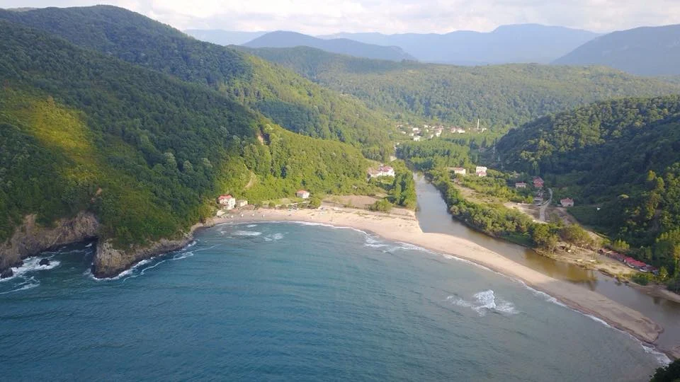
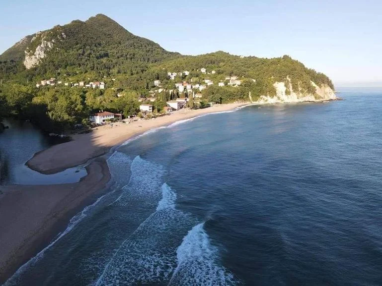
Gideros — the one you came for
About 11 km west of Cide, the road bends inland slightly and a small road heads down toward the water. Take it.
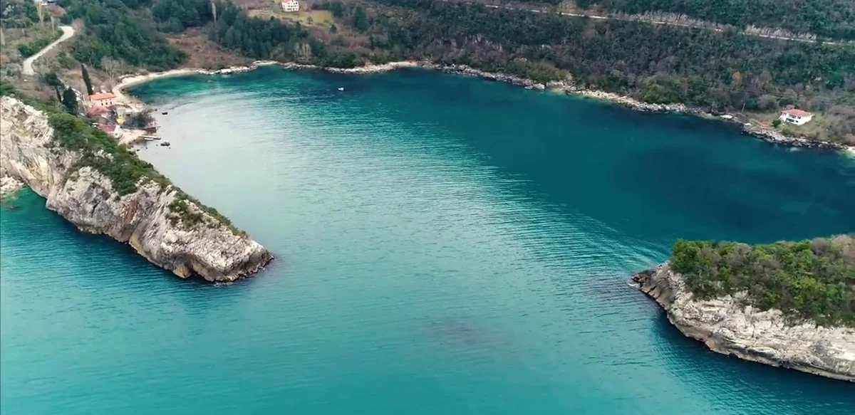
Gideros is the hidden gem of the whole Turkish Black Sea coast, and the bay I will tell anyone to make their first Black Sea night. It is a near-enclosed natural harbour, classed as a first-degree natural protected site (and second-degree historical site), in a fold of the coast that geographically hides it completely. From the open sea, the entrance to the bay reads as solid mountain — the cove “disappears” — which is why pirates and smugglers used it historically, and why locals say arms were hidden here during the War of Independence. Take that, like everything ancient on this coast, as local lore rather than verified history. The name is sometimes attributed to Genoese origins, and the wider area is sometimes linked by locals to Kytoros, the boxwood port mentioned in Homer’s Iliad. Lovely stories. Carry them lightly.
What’s not lore is the forest. Chestnut, oak, beech, boxwood (şimşir), and pine come right down to the water. The cove is dark green and the water is clear. There is a paid forest campground by the cove — basic, no showers when I last stayed, a couple of squat toilets near the old stone mosque, fish restaurants and small pensions nearby for when you want a roof. The access lane is narrow but easy on a bike; you’ll be glad you’re not riding something with hard panniers wider than your bars.
This is the night to spend on Day 1. Pitch in the late afternoon, swim, eat fried fish at one of the restaurants for not very much money, sleep with the door of the tent open. Mosquitoes are real here in July; bring repellent or a mesh inner.
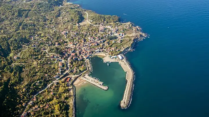
Cide
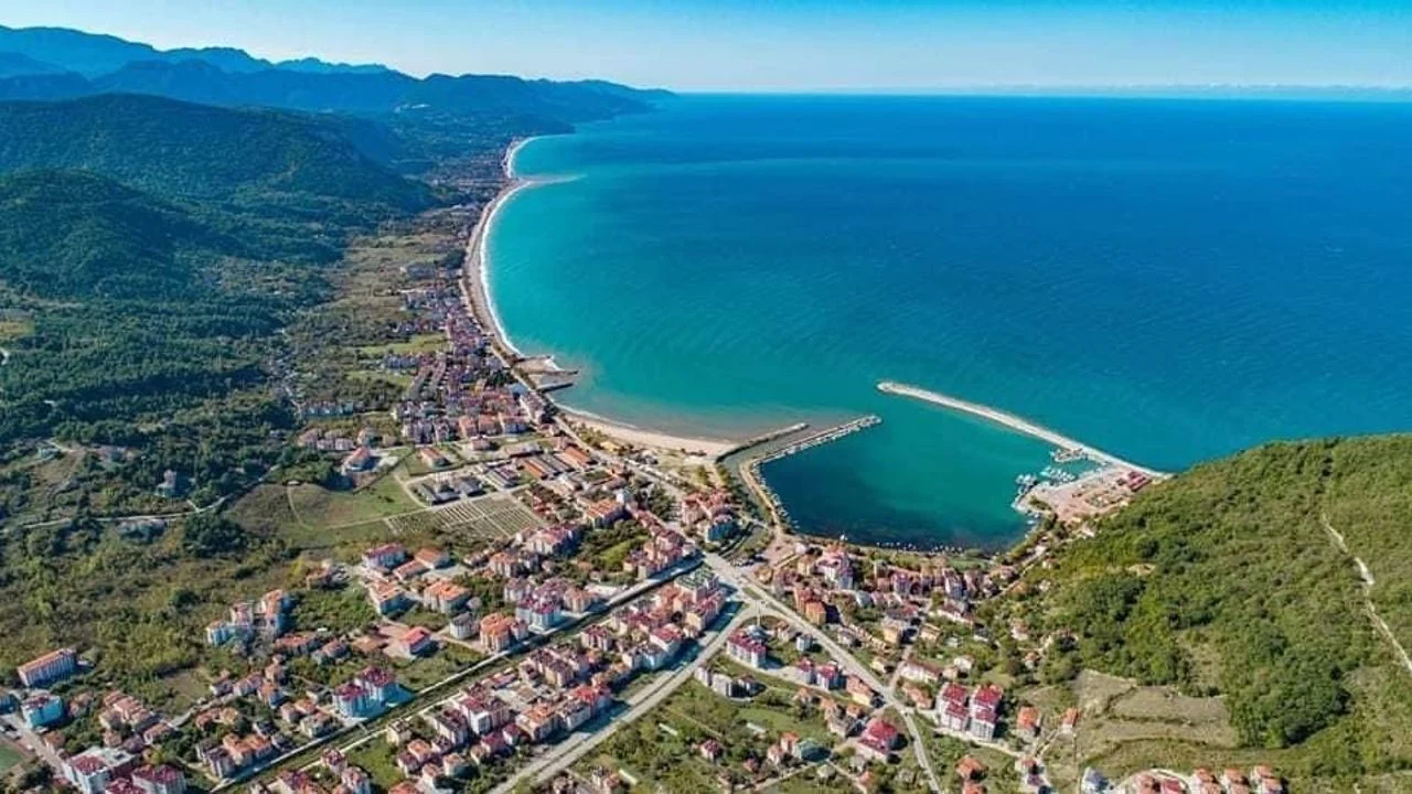
If Gideros is full, or you want a roof on a wet night, push the last 11 km east to Cide. Cide is a long beach town — proper sand, surfable swell when the wind is up, plenty of small pensions and a couple of restaurants on the front. This is your restock point before pushing on to Sinop. Pharmacy, ATM, decent grocery, a couple of bike-friendly mechanics if you ask around.
Road notes: D010 the whole way. Continuous tight curves, sections of cliff road cut into the rock above the sea, slow average speed (treat 90 km as a full day, not an hour). Fuel in Amasra, Kurucaşile and Cide; carry water — village taps work, but summer streams are mostly dry. Watch for gravel patches in road-repair sections, the occasional shepherd’s herd, and overhanging branches in the boat-village stretches.
Day 2: Cide to Sinop (~280 km)
The road continues to do its thing east of Cide. Tight, winding, slow, and gradually you climb away from the water for stretches before dropping back to a bay. There are days in your riding life when you should turn the music off and listen to the bike and the surf and the kids on bicycles in fishing villages. This is one.
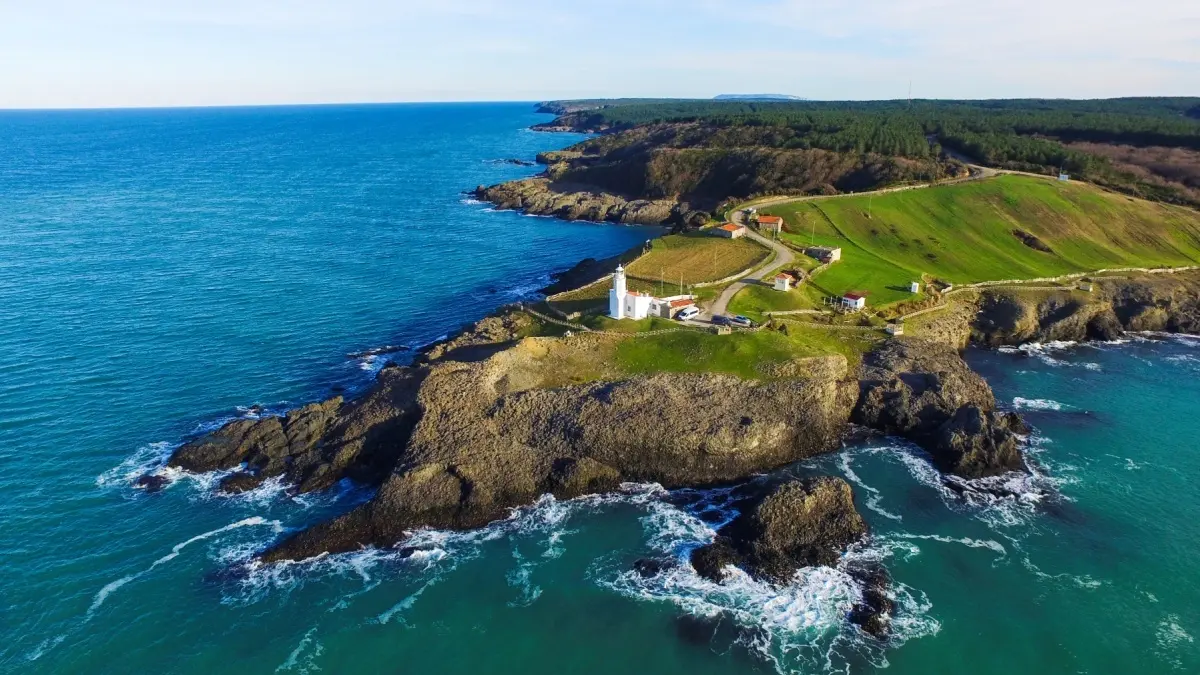
The destination is Sinop, the northernmost point of mainland Turkey, sitting at the end of a fat peninsula that the road takes its time getting to. The headland (Sinop Burnu, with İnceburun further out) makes for a calm late-afternoon ride if you arrive with light to spare. Hamsilos, a fjord-like inlet northwest of the town, is the obvious sunset spot — narrow, deep, dark green, with footpaths along the shore.
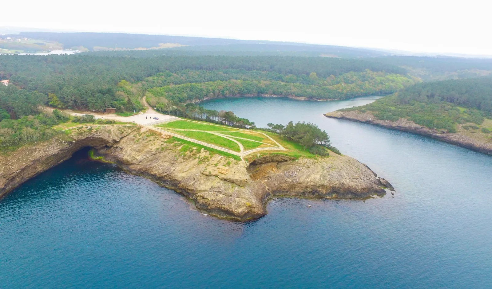
Sinop itself has a working harbour, an old prison built inside the citadel walls that is now a museum, and enough cafés and kebab places that you can spend an evening doing nothing in particular. There are quiet wild-camp possibilities around the headland if you don’t want a roof; the Sinop municipality is more tolerant than most about discreet tent-up-after-sunset behaviour.
Road notes: D010 the whole day, with a few inland-then-back-to-sea sections. Longer than Day 1, but still nowhere near motorway pace. Fuel is reliable along this stretch. The road surface is mostly good; watch for gravel washouts after summer storms.
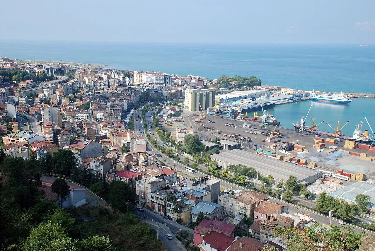
Day 3: Sinop to Ordu (~330 km)
Honest section: this is the least exciting day on the route. The road past the Samsun conurbation is faster and more transactional. You’re covering distance to get back to the good stuff. Hazelnut groves start to dominate the hillsides — by the time you’re near Ordu you’ll see the harvest racks if you’re riding in late summer.
Ordu itself has a redeeming feature: the Boztepe cable car up to the bay panorama above town. Take it. Half an hour up, a tea at the top with the bay spread out below, half an hour back down. Cheap accommodation, quiet evenings, and you’ve reset for the better day tomorrow.
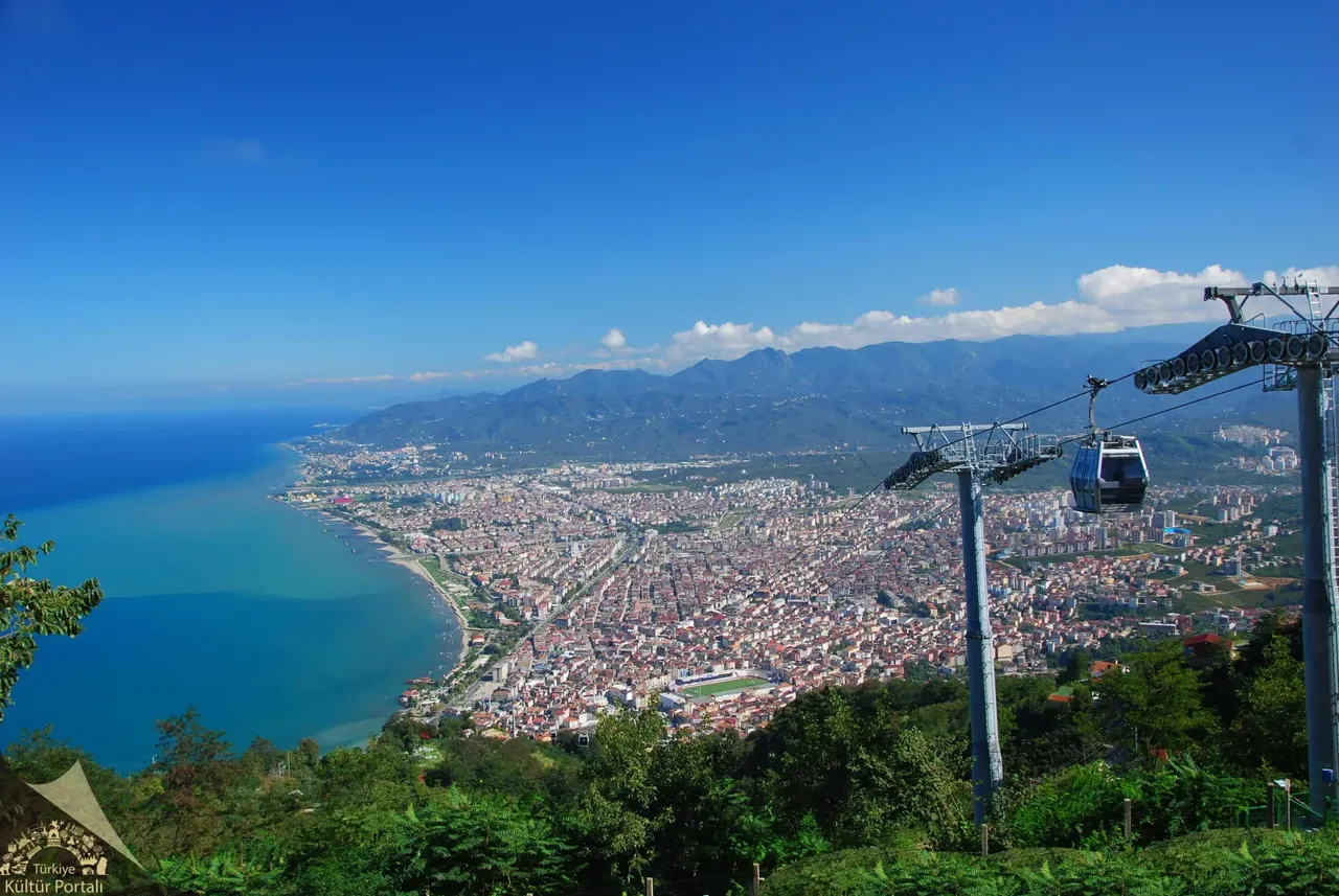
If you only have five days for the whole route, this is the day to compress — push from Sinop to Trabzon in one savage run and skip Ordu. But I’d rather you took six days and arrived at the mountains rested.
Road notes: D010 main coastal highway. Faster, more traffic, more towns, occasional truck convoys. Fuel everywhere. The most “ordinary” riding of the trip.
Day 4: Ordu to Trabzon via Giresun (~180 km)
This is the day the coast turns into the eastern Black Sea proper. Green gets a different green. The hills come closer to the water. Rain becomes likely — not certain, but likely — at some point in the afternoon. Pack the waterproofs at the top of the bag.
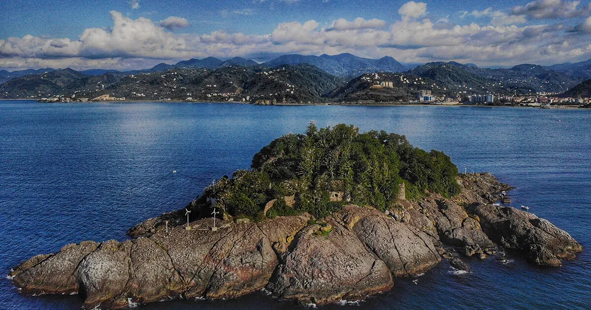
Giresun is a hilltop castle town with a panorama over the bay that justifies the climb up to the kale. Offshore, Giresun Island is the only true island in the Turkish Black Sea, a small rock you can see from the castle viewpoint with a tangle of legend around it (Amazons again — local lore, carry lightly). Lunch in town on a slow plate of pide.
Roll into Trabzon in the late afternoon. Trabzon is the regional capital of the eastern Black Sea — a real city, with traffic and noise and good kebabs and the last serious motorcycle service options before the mountains. If you’ve been worrying about a tyre, a chain or a noise from the bike, this is where to fix it. There are competent independent shops; ask at any bike café and someone will point you. For a tyre check, I usually pre-book a slot the day before — see also the gear context in best adventure motorcycle tires 2026 if you’re choosing tread for both coast and gravel.
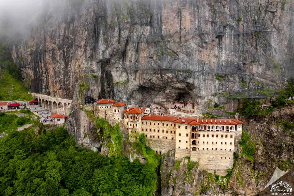
The obvious side quest leaving from Trabzon is Sumela Monastery — a Greek Orthodox monastery built into a vertical cliff face about an hour inland, dramatic in person, badly photographed online. If your day works out, do Sumela as a half-day from Trabzon and stay a second night in the city before climbing.
Road notes: Coastal highway, with the urban density building toward Trabzon. Rain probability up. Watch for slick painted lines in town.
Day 5: Trabzon to Ayder Yaylası (~170 km)
The day you leave the sea.
Ride east along the coast to Pazar in Rize province. Pazar is the last full-service coastal town and the turn inland. Fill the tank here. Fuel thins out the moment you point the bike uphill, and I would not want to be looking for petrol once you’re above Çamlıhemşin.
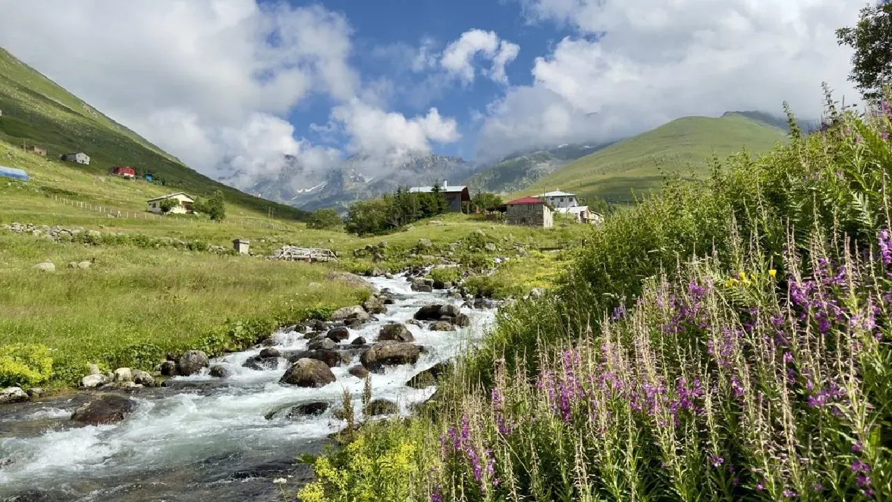
From Pazar, take the road inland through Çamlıhemşin, then begin the steep climb to Ayder Yaylası. This is about two hours of tight, winding mountain road — first and second gear in places, with hairpins and a couple of stream crossings where the road is just a wet slab of concrete. The forest closes in. You’ll feel the temperature drop ten degrees in the climb.
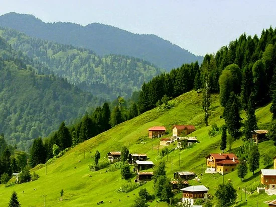
Ayder is a high plateau village known for hot springs and a clutch of hotels and pensions. I’ll be honest: Ayder itself is genuinely crowded and overpriced in peak summer. The hot springs are worth doing if your legs are tired. The actual camping is not in Ayder village — it’s up higher, where the asphalt ends and the gravel begins. If you can, get a hot meal in Ayder, fill water bottles, and push another half hour up the mountain before pitching.
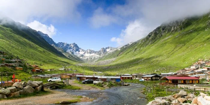
Above roughly 2,000 metres, nights drop to around 5°C even in August. This is the difference between a comfortable night and a miserable one. I’d reach for the warmer of the two bags I cover in the sleeping bag guide for this section — leave the summer bag at home.
Road notes: Coastal road, then a tight steep mountain climb above Çamlıhemşin. Asphalt becomes gravel as you climb above Ayder. Last reliable fuel is in Pazar — top up there, not later.
Day 6: Ayder to Yusufeli — Trans-Kaçkar (~110 km)
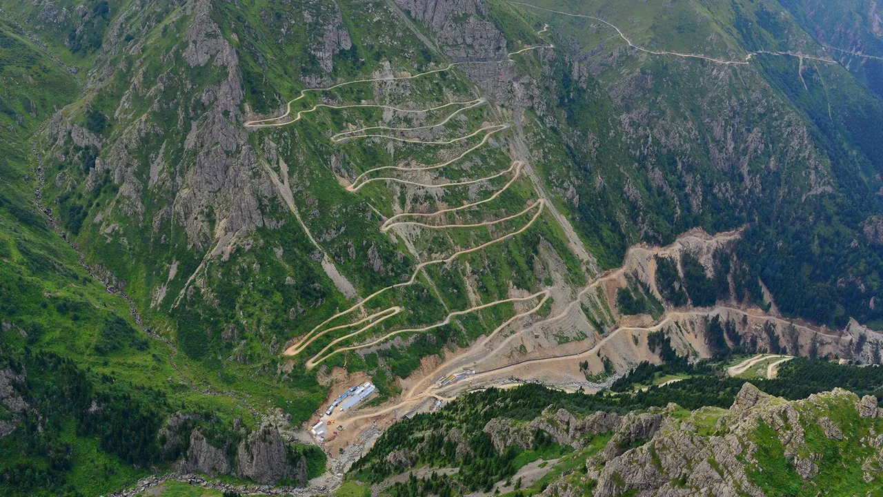
This is the day. Start early. Sleep cold, wake at 06:00, on the bike by 07:00, gravel by 08:00.
The Trans-Kaçkar route from Ayder toward Yusufeli is the finale of this trip and the best riding day I’ve had in Turkey. Above roughly 1,800 metres the asphalt ends. The road becomes loose gravel — hairpin after hairpin climbing into yaylas (high summer pastures), stream crossings where the snowmelt is still coming through in July, and passes that nudge 3,000 metres before the road tips over into the Çoruh valley.
You don’t need a 1200 GS for this. You need:
- Confident footwork on loose surfaces.
- Tyres that can deal with both wet asphalt below and gravel above.
- A bike you can pick up alone.
A small single (the CFMOTO 250, a CRF250, a WR250R, a Himalayan, even a well-tyred DR-Z) is genuinely the right tool. Big-bore tourers struggle on the gravel hairpins, not because of horsepower but because of weight. I’ve watched a fully loaded R 1250 GS pivot in a hairpin and need three of us to lift it. I rode past on a 250 and didn’t feel underbiked once.
Two hard warnings:
Kangal dogs. Above the tree line you ride into shepherd country. The Anatolian Kangal is a 60–65 kg working livestock guardian dog. Not a pet. Not bluffing. If you camp anywhere near a sheep flock, you will meet one. The rule is: stop, slow movement, no eye contact, do not run. Do not pitch within sight of a flock. If you hear bells in the dusk, ride another kilometre and find different ground. The dogs are doing their job; your job is not to look like the threat. There’s more on managing camp encounters in the solo motorcycle camping safety guide.
Cold and weather. Even in August, nights at altitude here are near freezing. Weather turns fast. A clear morning can become a cloud-bowl by 14:00 with rain that’s effectively cold sleet at 2,800 m. Ride the high section in the morning when the visibility is best. There are no shortcuts off the mountain — once you commit to the pass, you commit to the descent into the Çoruh valley.
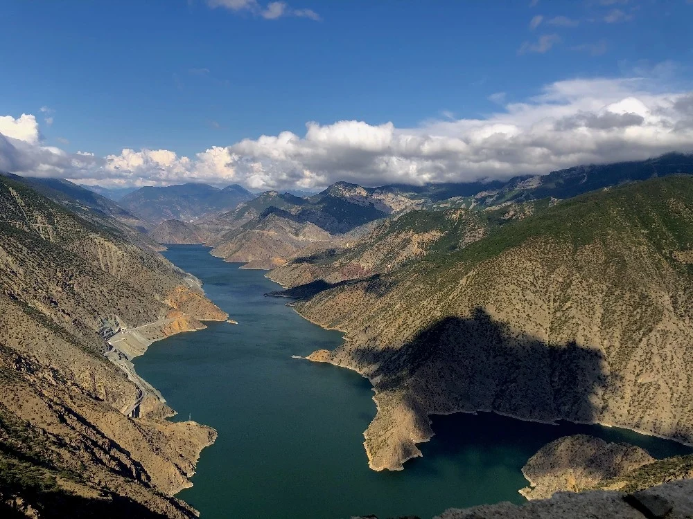
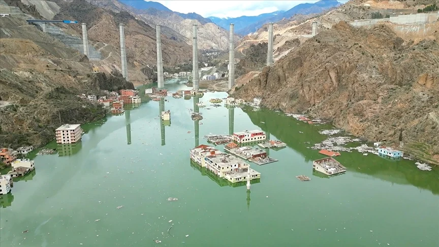
The descent toward Yusufeli is its own reward. The road drops through Caucasian fir and pine, past chapels and stone bridges, into the rafting country of the Çoruh. Note clearly: the old town of Yusufeli was flooded by the reservoir of the Yusufeli Dam on the Çoruh and the population was relocated to a new town higher on the valley side, which opened in stages from 2022. If you arrive expecting the old town from older guidebooks or older blog posts, you’ll be looking for somewhere that no longer exists. You’re arriving at the new Yusufeli. It’s a working town with hotels, restaurants and fuel — and it’s the gateway, if you want to push on, to Artvin, to Georgia, or to the back roads west.
I usually take a rest day in Yusufeli. After Ayder I always feel it in my hands.
Road notes: Gravel above Ayder. Tight hairpins, stream crossings, ~3,000 m passes. No fuel between Ayder and Yusufeli — leave Ayder with a full tank and, if you can carry one, a small reserve. Phone signal is patchy to non-existent on the high pass; do not depend on it. Emergency number is 112.
Best Season — by Region
| Region | Best months | Notes |
|---|---|---|
| Western coast (Amasra → Sinop) | Jun – Sep | Coolest in Jul-Aug compared to south coast; rain always possible |
| Central coast (Sinop → Trabzon) | Jun – Sep | Hazelnut harvest activity in Aug-Sep adds traffic on minor roads |
| Eastern coast (Trabzon → Pazar) | Jun – Sep | The wettest stretch; pack proper waterproofs |
| Kaçkar high plateaus (Ayder → Yusufeli) | Jul – Aug only | Snow risk and pass closures from mid-Sep; nights ~5°C even in Aug |
| Çoruh valley (Yusufeli) | May – Oct | Hot in midsummer, cool autumn nights |
The honest framing is this: the Black Sea is the summer answer when the Aegean and Mediterranean are 38–42°C and crowded. You’re swapping guaranteed sun for green, cool, empty and cheap. You’ll wear a fleece while friends down south are melting.
Apps, Navigation, and Gear Notes
A short, practical loadout for this route.
Park4Night and iOverlander. Solid coverage west of Sinop, thinner east of Samsun. iOverlander has the motorcycle-specific notes you actually want — entries that say “passable on a single, not a 1200 GS” save you hours.
Maps.me offline. Download Bartın, Kastamonu, Sinop, Samsun, Ordu, Giresun, Trabzon, Rize and Artvin provinces before you leave. Google Maps is fine on the coastal highway and unreliable as soon as you go up a valley.
Water filter or tablets. Needed in the Kaçkar yaylas and useful for the Black Sea stream zones. Unnecessary on the coast where village taps are reliable.
Power. A 10,000 mAh power bank covers one night off-grid; 20,000 mAh covers two. Charge whenever you stop for tea.
Emergency. Dial 112 in Turkey for all emergencies. Signal is reliable on the coast and patchy above Ayder.
The bike. Anything from a 250 single up will do the whole route. A small single is genuinely well-suited to both the narrow coast road and the Kaçkar gravel. The cliché “you don’t need a 1200 GS to do this” is true. You need confidence on loose ground, a tyre that doesn’t squirm on wet asphalt, and the willingness to ride slow. If you’re choosing rubber, the considerations in the best adventure motorcycle tires 2026 guide apply directly to this route.
For camping kit, you want a tent that handles wind at altitude, a pad that insulates against cold ground, and a stove that lights at 2,800 m in damp air. See:
- Best motorcycle camping tents
- Best compact sleeping pads for motorcycle camping
- Best portable camp stoves for riders
- Best sleeping bag for motorcycle camping 2026
If your pack plan still isn’t sorted, the how to pack a motorcycle for a 2-week camping trip walkthrough lays out a layout that fits this kind of mixed coast-and-mountain run.
For more general off-road context across the country, the Turkey TET route guide is the dual-sport counterpart to this article — different terrain, same philosophy.
What Nobody Tells You
After three full runs of this route on the CFMOTO 250NK, here are the lessons I keep handing to riders who ask.
1. The narrow coast road is the reason it’s empty. Slow down. Treat distance in hours, not kilometres. Day 1 is 90 km. It will take you a day. Trying to “make time” on the D010 just gives you sore wrists and a worse trip.
2. Gideros is the soft-landing first bay night. Do that one first and the rest of the coast makes sense. Once you’ve slept in a near-enclosed harbour surrounded by chestnut forest, you understand what this coast is for. Without that night, the coast can feel a bit grey and a bit hard to read.
3. The Black Sea beats the Aegean in July and August. And almost no foreign rider knows it. While the south coast is 40°C and the bays are full of charter boats, the Black Sea is 26°C, cloudy in the afternoon, and you can pitch a tent on a beach and have it to yourself. This is the open secret of Turkish summer riding.
4. Ayder is the tourist trap; the camp is the gravel above it. Spend two hours in Ayder — eat, soak in the thermal pool, fill water — and then climb another half hour for the night. The actual mountain is where the route earns its name.
5. Kangal dogs in the Kaçkar are not a joke. Manage the meeting, don’t test it. Don’t pitch near sheep. If you hear bells, ride on. Slow movement, no eye contact, no running. They are the most serious animal you will meet on this trip.
Route-Specific Packing Checklist
What to add to your normal touring gear for this trip specifically:
- Warm sleeping bag (comfort to roughly 0°C) — not your summer bag.
- Mesh inner for the tent (Gideros mosquitoes in July).
- Light fleece + waterproof shell layer — coast and altitude both ask for this.
- Spare gloves for the cold pass mornings on Day 6.
- Tyre plug kit and a small compressor — gravel debris on Day 6.
- 1 litre fuel reserve if your tank range is under 200 km — Ayder to Yusufeli has no petrol.
- Repellent (DEET or picaridin) for the coast bays.
- Offline maps for nine provinces (see above).
- Cash in Turkish lira — small village restaurants and the Gideros campground prefer it.
- A power bank, charged.
- 112 saved on the lock screen.
Where This Route Connects
This trip lives next to a few other guides on the site:
- For the southern counterpart on turquoise water and warm sea, see the Lycian Way motorcycle route guide.
- For wild-camp legality and regional logic across Turkey, see wild camping in Turkey on a motorcycle.
- For dual-sport adventures inland, see the Turkey TET route guide.
- For more bay-night ideas, the remote Turkish bays only an adventure motorcycle can reach is a good companion.
FAQ
The six questions I get most often about this route are answered at the top of this article. The short version: ride coast-to-Kaçkar in 6 days, do it in July or August when the south is cooking, sleep at Gideros on Day 1, respect the Kangals on Day 6, and remember that Yusufeli is the new town now.
The honest summary of the whole route is the one the man at the next table gave me in Amasra. Yavaş git. Go slow. The Black Sea is not a coast you cover. It’s a coast you arrive at, one small village at a time, until one morning you’re at 3,000 metres watching the cloud drop into the Çoruh valley and you realise the whole country has been quietly green and cold and empty behind you the whole time.
This guide is based on multiple personal trips along the route. Some links in this article are affiliate links — if you buy gear through them, we may earn a small commission at no extra cost to you.
Frequently Asked Questions
When is the best time to ride the Black Sea coast and the Kaçkar Mountains?
Coast: June through September is the comfortable window — daytime around 26°C, rain always possible. Kaçkar high plateaus: July and August only. Mid-September brings snow risk and closing passes, and even August nights at 2,000 m drop to around 5°C. The trade-off is real — you swap guaranteed sun for green, cool, empty, and cheap.
Can I ride this on a small bike like a CFMOTO 250?
Yes. I did it on a CFMOTO 250NK and never felt undergunned. The coast road from Amasra to Cide is paved, narrow and slow — a small bike actually fits the road better than a big tourer. The Kaçkar gravel above Ayder is the only part that tests skill, not displacement. Tyre choice and footwork matter more than cc.
Is Gideros worth the detour?
Gideros is the single best bay night on the whole Turkish Black Sea coast. A near-enclosed natural harbour surrounded by chestnut and boxwood forest, with a small paid forest campground by the water. Basic facilities (no showers when I was last there) and a narrow access lane, but flat ground, swimming, and total quiet on weekdays. If you do one wild-camp night on the coast, do this one.
How do I handle Kangal dogs in the Kaçkar?
Take them seriously. A working Kangal is a 60–65 kg livestock guardian, not a pet. If one approaches: stop moving, no eye contact, no fast hands, no running. Do not camp within sight of sheep flocks. If you hear bells in the dusk, ride on another kilometre and pitch somewhere else. The dogs are doing their job — your job is not to look like the threat.
What about Yusufeli — is the old town still there?
No. The old town of Yusufeli was inside the reservoir of the Yusufeli Dam on the Çoruh and was relocated to a new site higher up the valley, which opened in stages from 2022. If you're riding in for the first time, you're arriving at the new town. The drowned old town is gone — don't go looking for it on the old map.
Is the Black Sea really cooler than the Aegean in July and August?
By a lot. While Bodrum and Antalya are pushing 38–42°C, the Black Sea coast averages around 26°C with afternoon cloud build-up. I've ridden through Cide in July wearing a fleece under a textile jacket while friends were melting on the south coast. That climate is the entire reason this route works in high summer.