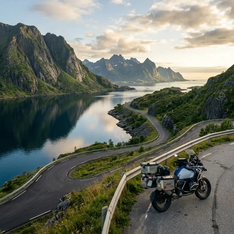
I spend most of my summers chasing warm water — Turkish coves, the Greek mainland, the bottom of the Adriatic, the kind of places where you ride down a dirt track, find a bay nobody’s on, and swim before the coffee’s even cold. Norway was supposed to be the opposite of all that. Cold, grey, expensive, no swimming. I went anyway, half out of curiosity, and came back understanding why people who ride Norway once spend the rest of their lives trying to get back.
It turns out Norway is a coast country too. It just keeps its bays on edge. The fjords are bays with the volume turned all the way up: water so still it mirrors a mountain, and you can pitch a tent right on the edge of it for nothing, legally, because Norway gives you that right. This is the Norway motorcycle route I’d hand anyone who asked: ten days riding north from Bergen, over the great fjord passes, along the Atlantic Road, up the wild Helgeland coast, across the Arctic Circle, and onto the islands of Lofoten where the road finally runs out at the edge of the sea.
It leans hard on Norway’s right to roam. The country-by-country wild camping legal guide explains why the north of Europe is so much freer than the south for a rider with a tent, and Norway is the best of the lot.
Why Norway Is a Coast Trip, Not a Mountain Trip
People sell Norway as mountains, and the mountains are extraordinary, but ride it and you realise the whole thing is organised around water. Every pass drops you back down to a fjord. Every coast road threads between the sea and a wall of rock. You’re never far from somewhere you could stop, kill the engine, and just sit by the water, and unlike home, you can sleep there.
That’s what makes it a Bikes and Bays trip rather than just another alpine blast. The riding is some of the best on earth — Sognefjellet and Trollstigen would headline any route in the world. But the thing I remember isn’t a corner, it’s a campsite: a flat patch of grass at the head of a fjord at half past ten at night, sun still up, a stove going, not another soul in sight, and not a single krone spent on the bed. The Mediterranean coast routes are where I’m most at home, but Norway is the one that made me rethink what a coast even is.
The Route at a Glance
| Day | Stage | Distance | Highlight |
|---|---|---|---|
| 1 | Bergen → Hardangerfjord | 150 km | Vøringsfossen, first fjord, the Hardanger orchards |
| 2 | Hardanger → Aurland | 130 km | The Snow Road, Stegastein, Nærøyfjord |
| 3 | Aurland → Lom (Sognefjellet) | 200 km | Norway’s highest pass, Jotunheimen |
| 4 | Lom → Geiranger | 150 km | Dalsnibba, the Geirangerfjord, Eagle Road |
| 5 | Geiranger → Åndalsnes (Trollstigen) | 120 km | The Troll’s Ladder, 11 hairpins |
| 6 | Åndalsnes → Trondheim (Atlantic Road) | 320 km | Storseisundet bridge, the coast leap |
| 7 | Trondheim → Helgeland coast | 250 km | Kystriksveien begins, Torghatten |
| 8 | Helgeland coast → Arctic Circle | 220 km | Seven Sisters, Svartisen, crossing 66°33′ |
| 9 | → Bodø → ferry to Lofoten | 180 km + ferry | Saltstraumen, the crossing north |
| 10 | Lofoten: Å, Reine, the beaches | 120 km | Arctic bays, the end of the road |
Total: roughly 2,000 km of riding plus a string of ferries, over ten days. The southern half is tight, technical fjord-pass riding; the northern half is long, open coast with the sea always on your left. Don’t rush it — in midsummer the daylight is endless, so the days stretch as far as you want them to.
Day 1: Bergen to the Hardangerfjord (150 km)
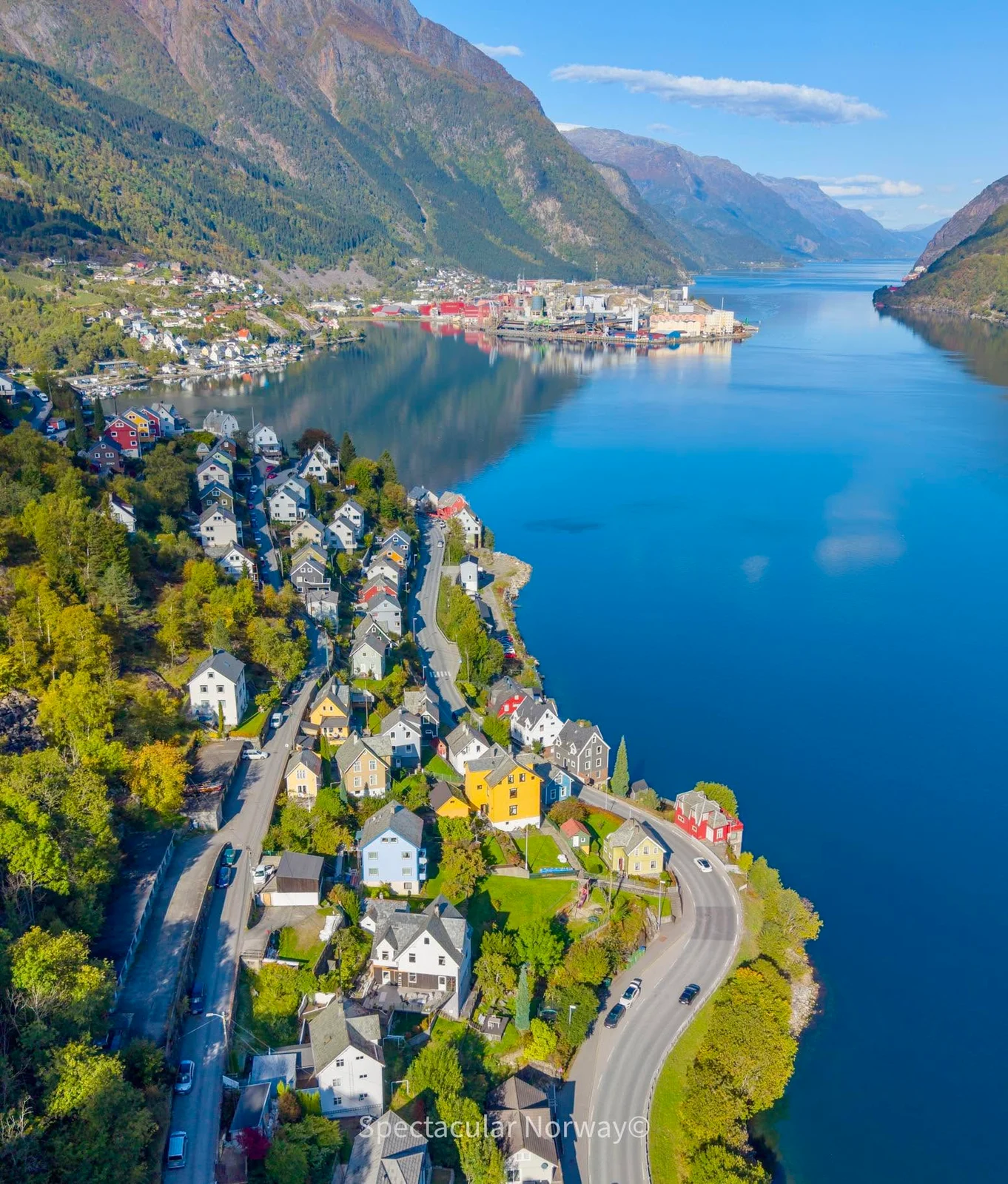
Most riders start in Bergen. It’s the obvious fly-and-rent point, and if you’ve shipped or ridden your own bike up through Denmark, the ferry from Hirtshals lands you on the coast nearby. Spend the morning in Bergen if the weather’s kind (it rains here more than almost anywhere in Europe, so don’t count on it), then point the bike east toward the Hardangerfjord.
Hardanger is the gentle introduction — broad, green, orchards on the slopes, the kind of fjord that eases you in before the big passes start. The highlight on the way is Vøringsfossen, one of Norway’s great waterfalls, with a vertiginous new footbridge across the gorge above it. End the day down on the water near Eidfjord or Kinsarvik. This is your first night under the right to roam: find a quiet spot off the road, 150 metres from any cabin, on the grass by the fjord, and get used to the idea that this is allowed and it’s free.
Road notes: Good fast roads out of Bergen, then the road tightens and improves as you reach the fjord. A short ferry crossing or the soaring Hardanger Bridge gets you over the water. Fill up in Bergen, and brace for the fuel price, because it doesn’t get cheaper.
Day 2: Hardanger to Aurland and the Snow Road (130 km)
A short distance, a huge day. Climb away from Hardanger toward Aurland, and take the old mountain road rather than the tunnel. The Aurlandsvegen, known as the Snow Road, a bleak, beautiful high crossing over a plateau of bare rock and meltwater that stays patched with snow into summer. It drops you to the Stegastein viewpoint, a curl of timber and steel that juts out over the Aurlandsfjord with nothing but air beneath the rail. Stand on it once and you’ll understand the whole trip.
Down at the bottom is Flåm and the arm of the Nærøyfjord, the narrowest fjord in Norway and UNESCO-listed — impossibly steep, impossibly quiet. Camp on the fjord side near Aurland.
Road notes: The Snow Road is single-track in places, slow, and can be cold and foggy up top even in July — carry a layer and don’t be fooled by the temperature you left at the fjord. If it’s socked in, the tunnel is the safe fallback. Worth gambling on a clear day, though.
Day 3: Aurland to Lom over Sognefjellet (200 km)
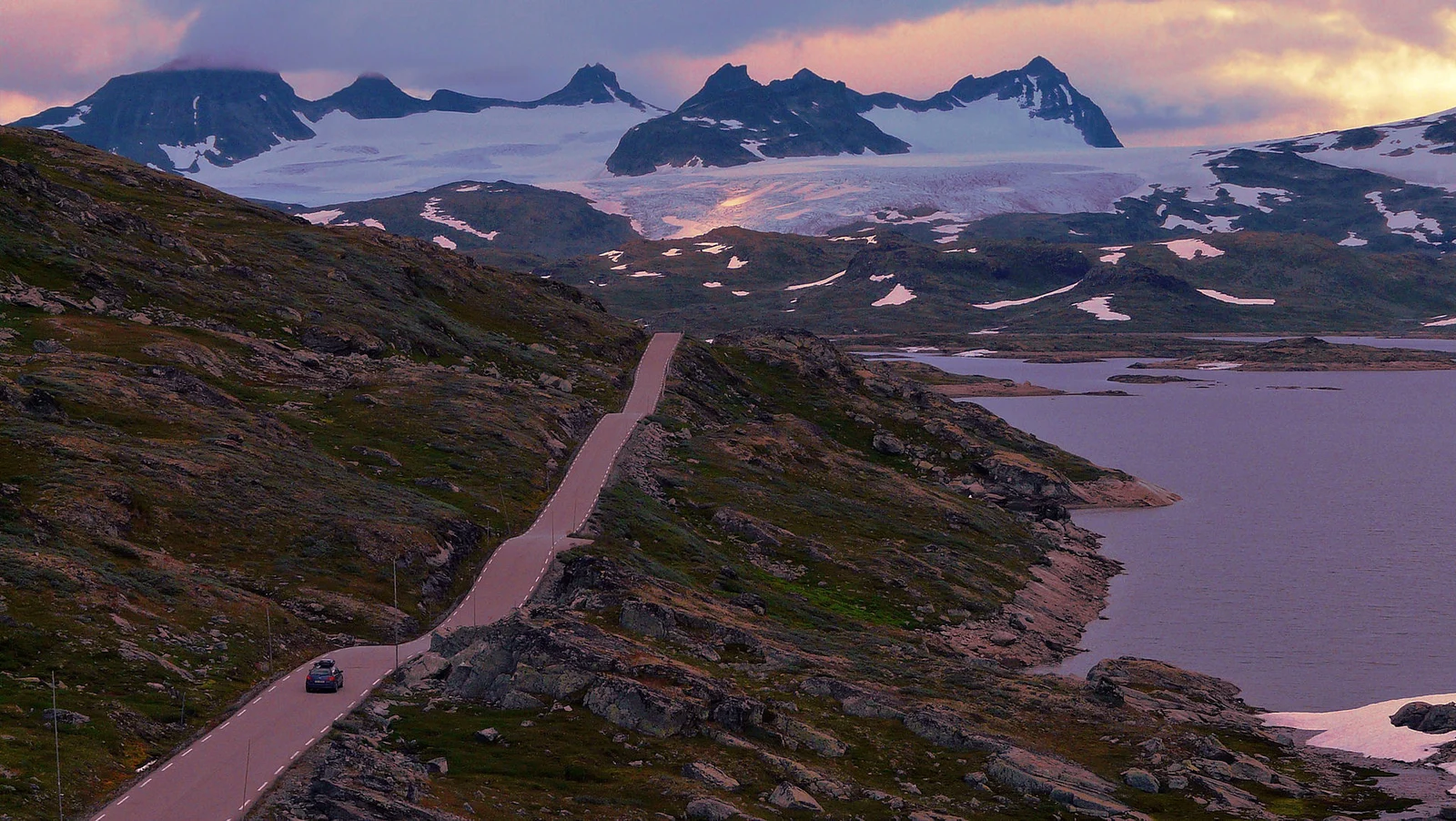
A ferry across the Sognefjord. The longest and deepest fjord in the country — sets up the day’s main event: Sognefjellet, the highest mountain pass road in Northern Europe, climbing to 1,434 metres through the edge of the Jotunheimen range. Up here it’s another planet: snowfields beside the road in midsummer, turquoise glacial lakes, peaks in every direction, and a temperature that can fall to single digits while the fjord you left was warm. It’s one of the great rides of Europe and almost nobody at home has heard of it.
The pass drops to Lom, a handsome valley town with a famous stave church and; mercifully; a proper bakery. Camp in the valley nearby.
Road notes: Superb, well-surfaced mountain road, open roughly late May to October depending on snow. cold at the top; this is the day you’re glad you packed for it. Fuel in Lom before or after; the high stretch has nothing.
Day 4: Lom to Geiranger (150 km)
From Lom, ride toward the most famous fjord of them all. The approach over the Dalsnibba — a toll mountain road climbing to a viewpoint at 1,500 metres — gives you the Geirangerfjord laid out far below before you’ve even dropped in. Then comes the descent: the Ørnesvingen, the Eagle Road, eleven hairpins falling to the water with the Seven Sisters waterfall across the fjord.
Geiranger itself is the postcard, and in summer it’s busy, cruise ships and tour buses, the one genuinely crowded spot on the route. Ride it for the road, not the village. Camp out of the centre on a quieter arm of the fjord, or push a little further on toward tomorrow’s start.
Road notes: Dalsnibba is a paid toll road but worth it on a clear day. The Eagle Road hairpins are tight and busy — take it steady, there are buses coming the other way. A ferry runs Geiranger–Hellesylt down the fjord itself if you want to ride the water as well as the road.
Day 5: Geiranger to Åndalsnes over Trollstigen (120 km)
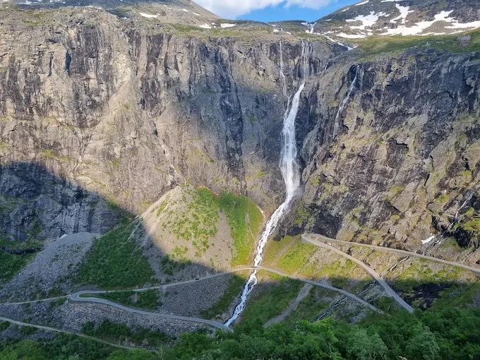
The big one. Trollstigen. The Troll’s Ladder — is eleven hairpins stacked up a near-vertical wall of rock, a waterfall crashing down the middle of it, a viewing platform at the top hanging over the drop. It’s the road every photo of Norway you’ve ever seen is taken on, and riding it is exactly as good as you hope.
A note that matters for 2026: Trollstigen was closed through much of 2024 after rockfalls and a landslide, reopened in 2025, and is running normally again for the 2026 season. It reopened on 27 April 2026, unusually early. Always check the day’s status before you ride up (the national tourist-route site posts live closures), because a single rockfall can shut it at short notice. Assuming it’s open, take your time; this is the corner you came for. The day ends down in Åndalsnes, under the Romsdalen peaks.
Road notes: Hairpins are tight, often wet, and shared with coaches — patience over pace. The platform car park fills by late morning, so ride it early. If it’s closed, the alternative is the longer valley road around, still beautiful.
Day 6: The Atlantic Road to Trondheim (320 km)
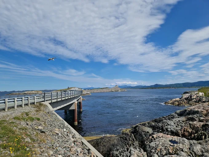
The longest day, and the one that takes you from fjord country out to the open ocean. The Atlantic Road — Atlanterhavsveien — is a short stretch of engineering madness: a series of low bridges hopping between skerries and islets across the mouth of the sea, the famous Storseisundet bridge curving up and away so steeply that from the right angle the road looks like it leaps clean off the end of the world. On a calm day it’s serene; when the Atlantic is up and the spray is coming over the rails, it’s something else entirely.
From there it’s a long ride round and inland to Trondheim, Norway’s third city and a good place to resupply, do laundry, and sleep somewhere with a roof if the weather’s beaten you up. This is the hinge of the trip; fjords behind you, the wild north coast ahead.
Road notes: A long transit day with the spectacular bit concentrated at the Atlantic Road itself. There are tolled tunnels and bridges on the way to Trondheim; have a way to pay road tolls (most are billed automatically to the plate via the AutoPASS system — sort this out before you ride). Fuel and food easy along this stretch.
Day 7: Trondheim and the Start of the Kystriksveien (250 km)
North of Trondheim the trip changes character completely. This is where the Kystriksveien — County Road 17, the Coastal Highway — begins, and for my money it’s the best-kept secret in European motorcycling: 650 km of coast road up the Helgeland shore, six ferry crossings, more than 12,000 islands offshore, and mountains dropping straight into the sea the whole way. National Geographic once put it on a list of the most scenic drives on the planet, and almost nobody rides it.
The first landmark is Torghatten, a mountain with a hole bored clean through it by the sea and ice. You can walk up and stand inside it. The rhythm of the coast road takes over here: ride a stretch, roll onto a ferry, cross a sound with the islands sliding past, roll off and ride again. Camp by the water, and up here, finding a perfect empty spot beside the sea is almost too easy.
Road notes: The ferries are the whole experience, not an interruption — no booking, just turn up, and in summer arrive 30 minutes early for the popular ones. They take cash or card and a bike is cheap. Build the timetable into your day; a missed ferry can mean an hour’s wait. Plan the long stages properly. The coast is remote and services thin out.
Day 8: The Helgeland Coast and the Arctic Circle (220 km)
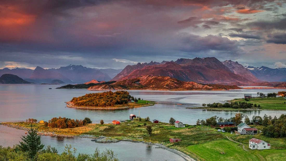
Keep working north up the Helgeland coast. The peaks of De syv søstre. The Seven Sisters — rise straight out of the sea beside the road, and inland you get glimpses of the Svartisen glacier, the second-largest in Norway, its blue ice hanging above the green. The UNESCO Vega archipelago lies offshore for anyone with time for a detour ferry.
Somewhere up here you cross the line that makes the whole trip feel like an expedition: the Arctic Circle, 66°33′ north. From here in midsummer the sun genuinely never sets — ride at midnight and it’s golden, not dark, and your sense of time quietly falls apart. It’s the strangest and best part of riding Norway in summer: there’s no reason to stop, so you don’t, and you find yourself making camp at an hour that would be the middle of the night anywhere else, in full daylight, by the sea.
Road notes: More ferries, more empty coast. Stock up on fuel and food whenever you pass a town. The gaps are long. Weather can swing fast on this exposed coast; wet and cold one hour, brilliant the next.
Day 9: To Bodø and the Ferry to Lofoten (180 km plus ferry)
Ride the last of the mainland coast to Bodø, pausing for Saltstraumen just south of the city. The strongest tidal current in the world, a maelstrom of churning water funnelling between two fjords that’s at its most violent around the turn of the tide. Then comes the crossing that delivers the finale: the car ferry from Bodø out to Moskenes, at the far southern tip of the Lofoten islands, three and a half hours across open water with the jagged Lofoten wall rising out of the sea ahead of you.
This ferry is worth booking ahead in summer. It’s popular and bikes aren’t guaranteed a spot on a full sailing. Roll off at Moskenes into the most dramatic landscape of the whole trip.
Road notes: Book the Bodø–Moskenes ferry in advance for July and August. It’s the one crossing on this route I wouldn’t leave to chance. Alternatively you can ride up to Lofoten overland via Narvik and the E10, but the ferry saves a long detour and the approach by sea is unbeatable.
Day 10: Lofoten — Reine, the Beaches and the End of the Road
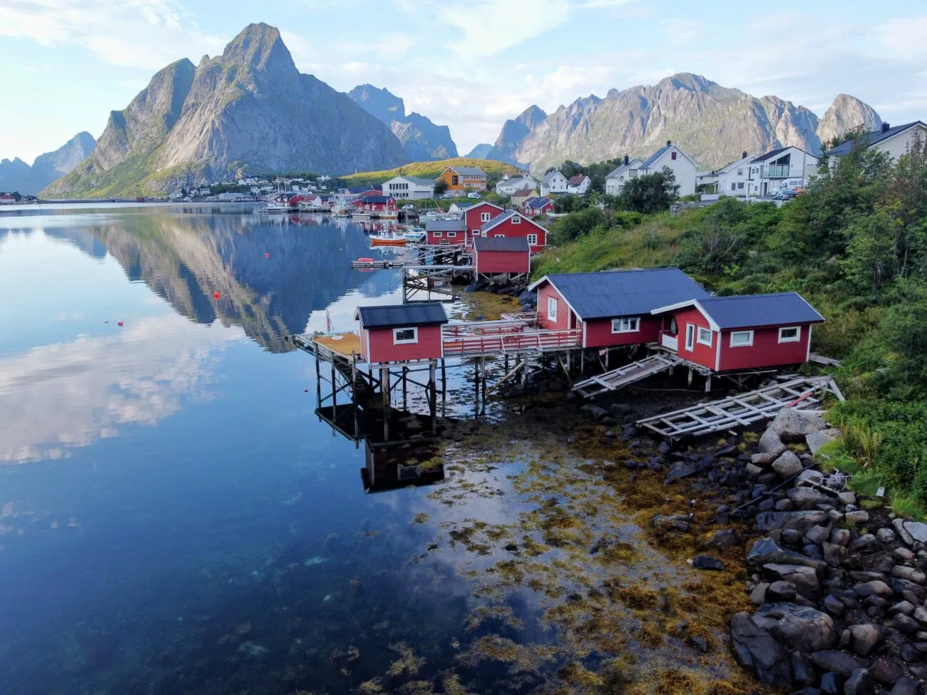
Lofoten is the reward, and it’s almost absurd: sharp black peaks shooting straight out of turquoise water, red rorbuer fishing cabins on stilts, and. The thing that breaks your brain — white-sand beaches and water the colour of the Caribbean, except it’s above the Arctic Circle and it’s freezing. These are the bays I came north to find without knowing it.
Ride the E10 down to Å, the village at the literal end of the road, then back up through Reine (the postcard one) and Hamnøy. Make time for the beaches: Kvalvika, a short hike in over a saddle; Haukland and Uttakleiv, the easy ones you can almost park at; and the surf beach at Unstad, where people genuinely surf in drysuits in water that should not be surfable. Push on to the gallery village of Henningsvær if you’ve got the day.
One honest caveat: Lofoten has been loved nearly to death, and the free-camping free-for-all is over. Several of the famous beaches and viewpoints now have local camping rules, signed restrictions and paid sites to protect the ground from the crowds. Read the boards, use the marked spots where they exist, and leave it better than you found it. This is the place where our right to roam is most at risk of being lost.
Road notes: The E10 is the spine of the islands — easy, gorgeous riding linking the highlights. Distances are short; the day is about stopping, not covering ground. Camp at the designated Lofoten sites or the spots that are still open, and follow the local signage to the letter.
What Norway Costs in Fuel, Ferries and Food (2026)
There’s no soft-pedalling this: Norway is one of the most expensive countries in Europe, and a few riders talk themselves out of the trip because of it. Here’s the honest picture for 2026, and why it’s still doable on a bike.
Fuel sits around 21 NOK a litre (roughly €1.85), having spiked past 26 NOK in parts of the country earlier in the year. It’s a tax policy, not a supply problem — Norway pumps its own oil and taxes the petrol hard. Budget for it and fill up in towns, because remote stations are pricier and sparser.
Ferries are constant on this route — a short Kystriksveien crossing is cheap for a bike (often well under 100 NOK), while the long Bodø–Moskenes run to Lofoten is the one real expense, a few hundred kroner. Add road tolls (handled automatically via AutoPASS plate billing) and the odd toll mountain road like Dalsnibba.
Food in restaurants is painful — a sit-down meal can wreck a day’s budget. So don’t. Shop the cheap supermarket chains (Rema 1000, Kiwi, Coop Extra), cook on your own stove, and eat like a camper.
And here’s the part that saves the whole thing: camping is free. Allemannsretten means your bed costs nothing, night after night, beside water that people pay fortunes to see. That single fact is what drops a Norway trip from “unaffordable” to roughly €60-90 a day riding and camping frugally. Most of which is fuel and crossings, not your bed. A rider with a tent travels Norway far cheaper than a tourist in a hotel ever could.
Norway Packing Notes
What this route asks for, beyond standard touring kit, and it asks for more than a Mediterranean trip does:
- Properly warm sleeping kit. Even in midsummer the fjord and mountain nights are cold. A warm sleeping bag and an insulated sleeping pad are not optional this far north.
- A tent that handles wind and rain, not a fair-weather one — see the camping tents guide. Exposed fjord and coast pitches get weather.
- Real waterproofs. Wet riding gear is the default assumption, not the exception. A genuinely waterproof jacket and pants earn their place every day.
- Heated grips or heated gear for the high passes and the Arctic coast; single-digit temperatures are normal up top in July.
- A stove and a real cooking setup, because eating out is what makes Norway expensive and cooking is what makes it affordable.
- A way to keep devices charged on long off-grid stretches; a power setup matters when you’re days from a town.
- An eye mask for sleep. The midnight sun is wonderful to ride under and impossible to sleep through.
- Cash and a card for ferries, and the AutoPASS toll situation sorted before you set off.
Best Season and Weather
Mid-June to mid-August: the only real window, and a glorious one. The high passes are open, and the midnight sun means endless riding daylight. You genuinely lose track of time in the best way. It’s also the busiest and priciest stretch, and the popular spots (Geiranger, Lofoten) feel it.
Late May and early June: the passes may still be clearing — Sognefjellet and the highest roads can stay shut after a heavy winter. But the lowland fjords and the coast are open, the waterfalls are at full meltwater roar, and it’s quieter. Check pass status before committing to the high route.
September: quieter still, with astonishing autumn colour, but the weather turns unsettled and cold and the high passes begin to close. A gamble that can pay off beautifully or soak you for a week. The thing that really ends the northern season is light, not temperature: by our calculation Bergen loses over five and a half hours of daylight between 1 September and 1 November, which is the argument for riding Europe’s autumn routes further south as the month goes on.
October to May: the passes are shut and this route isn’t on. Norway in winter is a different, specialist trip, not this one.
Internal Connections
This route ties into the wider riding and wild-camping coverage on Bikes and Bays:
- It’s built on Norway’s right to roam. The Europe-wide wild camping legal guide puts allemannsretten in context against the rest of the continent.
- For how the fjords stack up against the warm-water riding I usually do, compare the best coastal motorcycle routes in the Mediterranean.
- A trip this long and this remote rewards proper preparation; see how to plan a long-distance motorcycle trip.
- And it’s a camping trip first and a riding trip second, so the full camping gear checklist is where to start kitting out.
FAQ
Five common questions are answered at the top of this page. The short version: ride Norway south to north over ten days, camp wild under allemannsretten the whole way to keep it affordable, go mid-June to mid-August for open passes and the midnight sun, and pack for cold and rain on any bike that’s well protected.
I went north expecting the opposite of everything I love about riding, and found the same thing in a colder key — a coast you can sleep beside for free, bays that happen to be vertical, and a midnight sun that makes you forget to stop. Whatever shape your own Norway motorcycle route takes, save your last night for Lofoten: a tent on the grass above an Arctic beach, the sea impossibly blue, the sun refusing to go down, and the bike ticking as it cools at the end of the road. You ride a very long way north to find that, and it’s worth every krone the petrol costs. If Norway is part of a longer European plan, our Europe adventure motorcycle routes guide puts this route in context with the Alps, the Pyrenees and the coasts further south.
This guide is based on personal trips along the route. Some links in this article are affiliate links — if you buy gear through them, we may earn a small commission at no extra cost to you.
Frequently Asked Questions
How long do you need to ride Norway from the fjords to Lofoten?
Ten days of riding is the honest minimum for the route in this guide — Bergen up through the fjord passes, along the Atlantic Road and the Helgeland coast, and over to Lofoten. You can do the southern fjord loop alone in five or six, but if you've come all the way to Norway, push on north; the Helgeland coast and the Arctic Circle crossing are the part nobody forgets. Two full weeks lets you breathe, sit out a rainy day, and not spend every evening chasing daylight — and in June and July there is no real darkness anyway.
Is wild camping legal in Norway on a motorcycle?
Yes, and it's the whole reason Norway is affordable on a bike. The right to roam — allemannsretten — lets anyone pitch a tent on uncultivated land (utmark) without asking permission, as long as you stay at least 150 metres from the nearest inhabited house or cabin, keep to two nights in one spot outside the mountains, and leave absolutely no trace. The bike has to stay on the road or in a legal parking bay — you can't ride out across the land to your tent. A few hotspots, especially in Lofoten and parts of fjord Norway, now have their own local camping rules and signed restrictions, so read the boards when you arrive.
When is the best time to ride Norway?
Mid-June to mid-August. The high mountain passes — Sognefjellet, the Geiranger road, Trollstigen — only clear of snow and open from late spring; Trollstigen reopened for the 2026 season on 27 April, but the very high roads can stay closed into June after a heavy winter. Ride in June or July and you get the midnight sun, which changes everything: you can ride until 11pm, set up camp in full daylight, and never fight for time. September is quieter and the autumn colour is unreal, but the weather turns and the passes start closing. Outside summer this route isn't on.
How expensive is a motorcycle trip in Norway?
Norway is one of the most expensive countries in Europe, and there's no pretending otherwise — petrol sits around 21 NOK a litre (roughly €1.85), a restaurant meal is painful, and the ferries add up. But camping is where it flips: wild camping under allemannsretten is free, and that single fact turns Norway from unaffordable into doable. Cook your own food from supermarkets (Rema 1000, Kiwi, Coop are the cheap chains), sleep beside the fjord for nothing, and your daily spend drops to fuel, the odd ferry and groceries. Budget roughly €60-90 a day riding and camping frugally — most of it fuel and crossings.
Do I need a big adventure bike for this route?
No. It's almost all sealed road, and brilliant sealed road at that — the fjord passes and the coast roads are paved, well surfaced and made for a bike that turns. A middleweight adventure bike or even a nimble tourer is ideal; you'll enjoy Trollstigen's hairpins far more on something light than on a fully loaded heavyweight. What matters more than capacity is weather protection and luggage that keeps your camping kit bone dry, because you will get rained on. Pack for cold and wet, not for off-road.