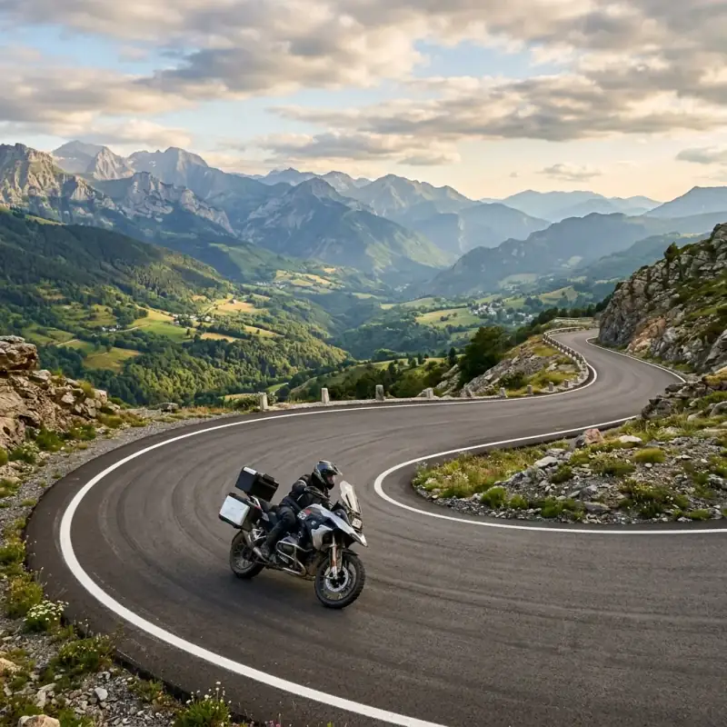
For years the Alps got all my mountain trips and the Pyrenees got none, which is exactly the mistake most riders make. The Alps are magnificent and busy; the Pyrenees are nearly as good and half-empty, with a road down the Spanish side that I’d put against any single road in Europe. Then there’s the part nobody tells you about: keep riding west past the mountains and you hit the Basque coast and the Picos de Europa, where green peaks fall straight into the Atlantic, and the trip stops being a mountain trip and becomes a coast trip too.
This is the Pyrenees motorcycle route I’d give anyone heading down to the top of Spain: eight days running west from the Mediterranean to the Atlantic side, taking in the legendary N-260, the great French cols, the Basque coast, and the gorges of the Picos de Europa. It’s a natural companion to the Alps route. The other great mountain ride in Europe, and if you’re coming from the UK, it begins right where the ferry to Spain drops you on the north coast.
Why the Pyrenees Beat the Alps for a Quiet Ride
The Alps win on sheer drama and on the famous passes, and they pay for it in traffic — campervans nose to tail on the Stelvio in August, tunnels and tolls, prices to match. The Pyrenees give you ninety per cent of the riding with a tenth of the crowds. The N-260 alone justifies the trip: 800 km of near-continuous curves down the Spanish side with almost nobody on it.
And then the Pyrenees do something the Alps can’t. They run down to two coasts. West of the mountains, the Basque shore and the Picos de Europa bring the sea into a mountain trip: fishing ports, green Atlantic peaks, and limestone gorges within sight of the water. It’s the most complete mix of mountain and coast in southern Europe, and it sits right next to France instead of deep in the middle of the continent. For a rider who likes empty roads and a bit of sea at the end, it’s the better mountain trip.
The Route at a Glance
| Day | Stage | Distance | Highlight |
|---|---|---|---|
| 1 | Cap de Creus → Eastern Pyrenees | 200 km | Mediterranean start, the climb begins |
| 2 | The N-260 west | 200 km | The great Spanish Pyrenean road |
| 3 | Val d’Aran → Bonaigua → France | 180 km | High pass, border crossing |
| 4 | Tourmalet and Aubisque | 200 km | The Tour de France giants |
| 5 | West to San Sebastián | 220 km | Into the Basque Country and the coast |
| 6 | Basque coast → Cantabria | 250 km | Fishing ports, Atlantic corniches |
| 7 | Picos de Europa | 200 km | La Hermida gorge, Covadonga lakes |
| 8 | Picos loop and ride out | — | Beyos gorge, the finish |
Total: roughly 1,450 km over eight days, running from the Mediterranean to the Atlantic. The first half is high-mountain pass riding on both sides of the border; the second half trades altitude for coast and the green, gorge-cut peaks of the Picos.
Day 1: Cap de Creus to the Eastern Pyrenees (200 km)
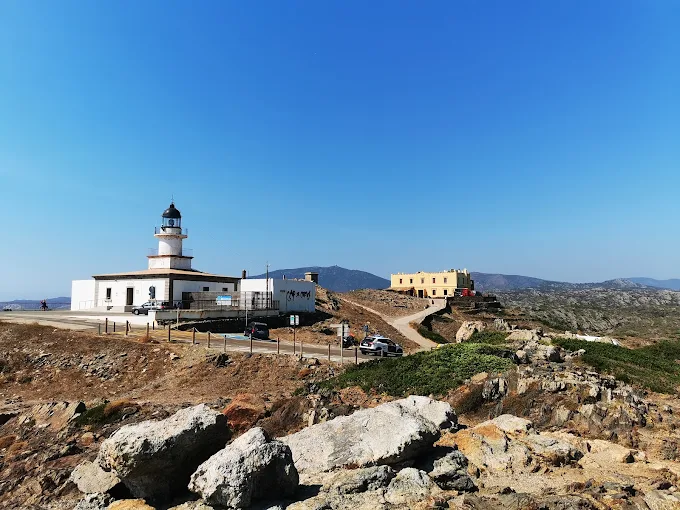
Start where the mountains meet the sea. Cap de Creus, the rocky headland at the eastern tip of the Pyrenees on the Costa Brava, is the symbolic beginning. The easternmost point of the range, all wind-bent rock and blue water, near the old fishing town of Cadaqués. From here the only way is up and west.
Climb away from the coast into the eastern Pyrenees through Catalonia — Camprodon, Ripoll, the green foothills — as the road starts to wind and the peaks build ahead. It’s a gentle first day by Pyrenean standards, easing you off the coast and up into the mountains, with the serious riding starting tomorrow.
Road notes: Good roads up from the coast, getting twistier as you gain height. Plenty of fuel and supplies in the Catalan towns. Campsites are easy to find in the foothills, and in Spain that’s the way to sleep, not wild.
Day 2: The N-260 and the High Spanish Pyrenees (200 km)
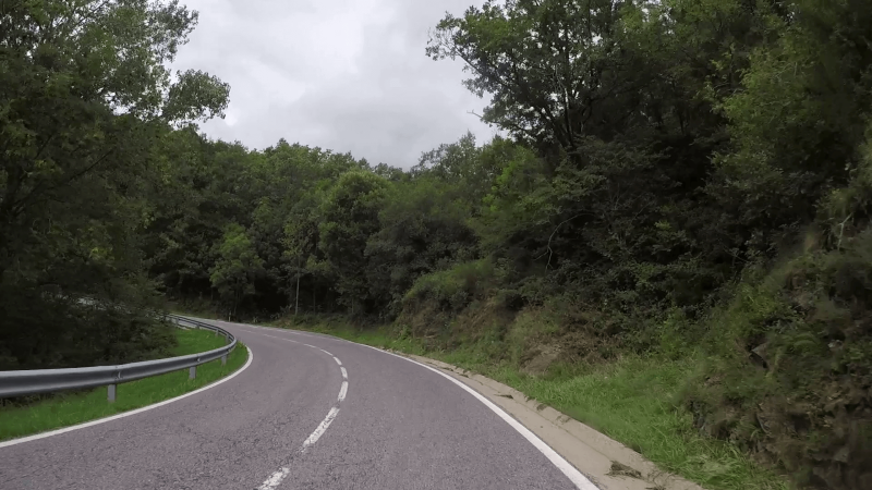
Today is the one you came for: the N-260, the Eje Pirenaico, the great road that strings the Spanish Pyrenees together. Pick it up and ride west through the high country — past La Seu d’Urgell (and the chance to dip into Andorra if you want the duty-free fuel and a passport stamp of sorts), through Sort and the gorges of the Noguera Pallaresa, into the heart of the Aragonese Pyrenees.
This is near-continuous curves: gorges, river canyons, mountain passes, excellent asphalt, and almost no traffic. It’s the kind of road you finish grinning into your helmet. Stop in one of the stone mountain towns for the night — Spain’s Pyrenean villages are handsome and cheap, and the camping is good.
Road notes: The N-260 is the highlight of the trip — flowing, well-surfaced, gloriously empty. Fuel in the larger towns; the high stretches between them are sparse. Andorra is a cheap fuel stop but its border can be slow in summer.
Day 3: Val d’Aran and the Port de la Bonaigua into France (180 km)
Climb the Val d’Aran, the green, Atlantic-facing valley high in the central Pyrenees, by way of the Port de la Bonaigua — a superb high pass that tops out above 2,000 metres with snow lingering beside the road into early summer. From Vielha, cross the border into France, where the character of the mountains shifts: lusher, the villages with slate roofs, the cols suddenly famous.
This is the day the trip changes countries and changes feel. On the French side the high mountain bivouac is tolerated if you do it properly — up high, after dusk, gone by dawn. So if you want a night wild in the mountains, this is where it becomes an option.
Road notes: The Bonaigua is a brilliant pass but high and cold up top; carry a layer. The border crossing is open and quick. Surfaces stay excellent into France.
Day 4: The French Giants: Tourmalet and Aubisque (200 km)
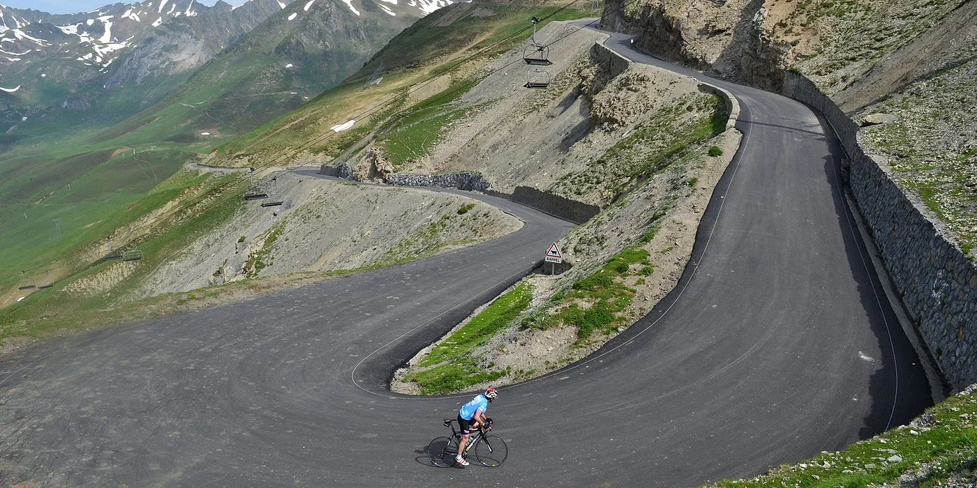
A day of legends. The Col du Tourmalet, at 2,115 metres the highest paved pass in the French Pyrenees and the most celebrated climb in cycling. It’s appeared in the Tour de France more than any other col — is a long, open, sweeping ascent you’ll share with road cyclists grinding up in the heat. Pair it with the Col d’Aubisque, its equally famous neighbour, on a balcony road that traverses a cliff face with the valley dropping away beneath you.
These are the cols every Pyrenean trip is built around, and riding them back to back is the high point of the mountain half of the route. Drop down into the western foothills for the night.
Road notes: Open, fast mountain passes rather than tight technical ones — watch for cyclists everywhere on the climbs, and for cattle wandering the high pastures. Both cols are seasonal; confirm they’re open if you’re riding early in the year.
Day 5: Into the Basque Country and San Sebastián (220 km)
Ride west out of the high mountains as they soften into the green, rolling Basque Country, and aim for the coast at San Sebastián (Donostia) — one of the most beautiful city beaches in Europe, a perfect shell-shaped bay ringed by elegant buildings, and a pintxos scene worth breaking the camping budget for one night. The contrast is the joy of this day: you start among 2,000-metre peaks and end with your boots in Atlantic sand.
This is where the Pyrenees properly hand over to the coast. The riding eases, the landscape greens, and the sea reappears for the rest of the trip.
Road notes: Good roads down out of the mountains; the Basque backroads are a pleasure. San Sebastián is a city — park sensibly and expect summer crowds. Campsites sit on the hills around the bay.
Day 6: The Basque Coast to Cantabria (250 km)
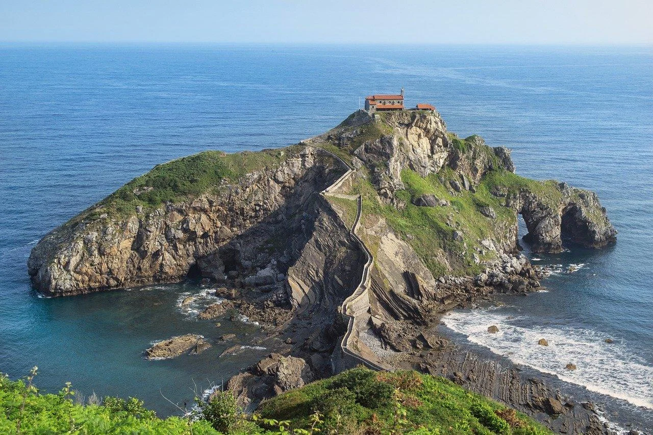
Follow the coast west along the Bay of Biscay. The wild, green, surf-battered north shore of Spain, a world away from the dry Mediterranean you started on. Ride the corniches and backroads between fishing ports and cliff-top viewpoints through the Basque coast and into Cantabria, past beaches the Atlantic keeps cool and empty even in summer. Aim for the Cantabrian coast within striking distance of the Picos.
This is the green, watery, Atlantic Spain most people don’t know exists — a coast of estuaries, surf beaches and small ports, and a lovely day’s riding to bridge the mountains and the Picos.
Road notes: Mix of fast coastal road and slow, pretty backroads — take the small ones. Plenty of fuel and supplies. The weather here is Atlantic: greener because it rains more, so pack for a shower.
Day 7: Picos de Europa: Gorges and the Covadonga Lakes (200 km)
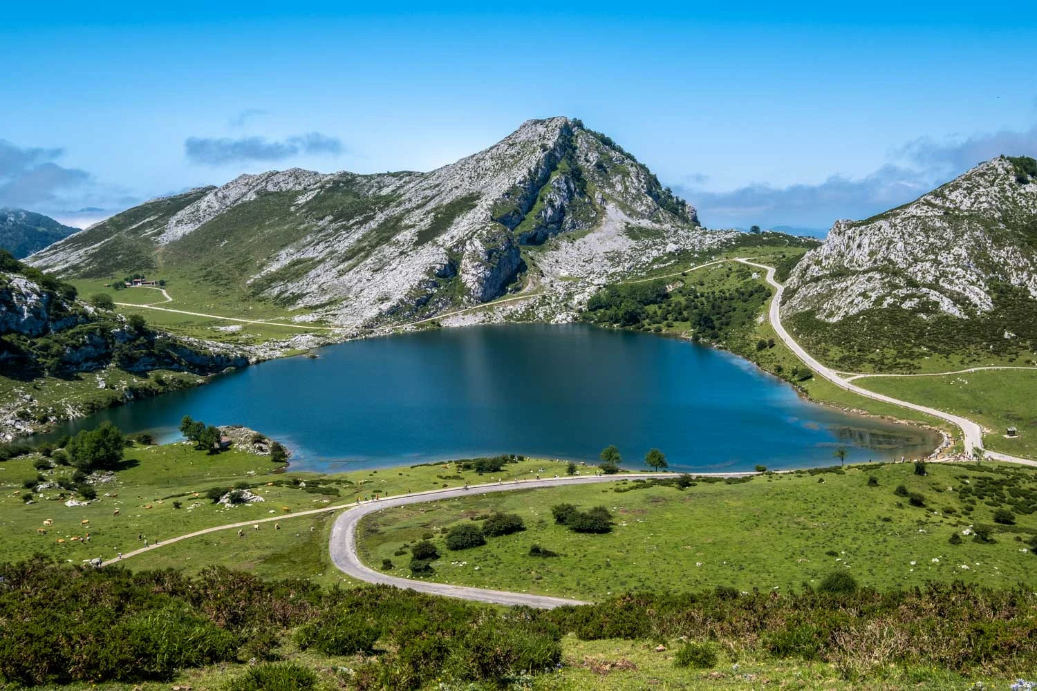
The grand finale, and for many riders the best of the whole trip. The Picos de Europa are a compact, ferocious limestone massif rising straight out of the Atlantic coast, cut by some of the most dramatic gorge roads in Spain. Ride the Desfiladero de la Hermida, the longest gorge in the Iberian Peninsula — 21 km of road hugging a river between limestone walls up to 600 metres high, and the Desfiladero de los Beyos, narrower still, following the Sella through walls that all but close overhead.
The signature climb is the road to the Lagos de Covadonga, a legendary ascent of tight hairpins and steep ramps to two glacial lakes high in the massif, past the basilica of Covadonga. One catch: in summer the lakes road closes to private vehicles during the day (bus only), so ride it early in the morning or out of peak season. Camp in one of the valley sites below the peaks.
Road notes: The gorge roads are narrow, spectacular and can be busy with tourist traffic — patience over pace. Some Picos mountain lanes have rougher asphalt; a nimble bike helps. Check the Covadonga access rules for your dates before you ride up.
Day 8: The Picos Loop and the Ride Out
Spend the last day completing a loop of the Picos. The massif sits across Asturias, Cantabria and Castilla y León, and a circular route of around 250 km links the three sides through more gorges, mountain villages and viewpoints. Then point the bike out: north to Santander or Bilbao for the ferry home, or back east toward France and the road north.
You finish a trip that started on a Mediterranean headland and ended in a limestone massif over the Atlantic, having ridden the best road in Spain, the most famous cols in France, and two coasts in between; eight days, two seas, and barely a traffic jam the whole way.
Road notes: A final day of gorge and mountain riding. Fuel up before the ferry ports or the long ride out. If you’re catching a ferry from Santander or Bilbao, build in time. The Picos are close but the roads are slow.
What Northern Spain Costs (2026)
The good news for the budget: northern Spain is far cheaper than the Alps. Fuel sits around €1.45-1.55 a litre — among the cheapest in western Europe, roughly 15% below the EU average and well under France, Italy or the Alpine countries, and Andorra is cheaper still if you pass through. Campsites are plentiful and inexpensive, rural guesthouses (casas rurales) are good value if you want a roof, and food — especially the Basque pintxos and the hearty mountain cooking; is excellent and reasonable off the tourist strips.
The costs to plan for are the ferry if you come from the UK (the Brittany Ferries crossing to Santander or Bilbao is the big one), and the fact that wild camping is off the table in Spain, so budget for campsites rather than free nights. Overall, a week here runs well below an equivalent Alpine trip; see the full European cost breakdown for how to price it.
Pyrenees Packing Notes
What this route specifically asks for, beyond standard touring kit:
- A warm layer for the high passes — Bonaigua, Tourmalet and Aubisque are cold and exposed up top even in summer
- Real waterproofs for the green Atlantic west; the Basque coast and the Picos see proper rain — a waterproof jacket earns its place
- A proper camping setup built around official sites in Spain — tent, pad, stove
- Knowledge of the France/Spain camping difference — official sites south of the border, responsible high bivouac north of it
- A check on seasonal road status. The high French cols and the Covadonga lakes road both have timing rules
- Offline maps; signal drops in the gorges and high valleys
Best Season and Weather
Late May to June: the sweet spot once the high cols clear of snow — open passes, green valleys, wildflowers and quiet roads before the summer crowds. Confirm Tourmalet and Aubisque are open if you go early.
September: the other ideal window — passes still open, crowds thinning, the green north at its best, and the Covadonga lakes road easier to ride out of peak season. Arguably the finest time of all.
July-August: good riding weather but the coast and the Picos get busy and hot, the Covadonga road restricts vehicles by day, and campsites fill. Rideable, but not the range at its quietest.
Winter: the high passes close and the north turns cold and wet. Not this trip’s season.
Internal Connections
This route ties into the rest of the mountain and coast coverage on Bikes and Bays:
- For where the Pyrenees sit among Europe’s other great rides — the Alps, the fjords, the coasts and the TET — see our ultimate Europe adventure motorcycle routes guide.
- It’s the natural twin of the Alps motorcycle route. The other great European mountain ride, busier and more famous.
- If you’re riding from the UK, it begins at the UK to Spain ferry landing on the north coast.
- For how the Picos and Basque coast rank against the wider region, see the best coastal routes in the Mediterranean.
- And to price the trip properly, use the European motorcycle trip cost breakdown.
FAQ
Five common questions are answered at the top of this page. The short version: ride the top of Spain east to west over eight days, build the mountain half around the N-260 and the French cols and the coast half around the Basque shore and the Picos, camp officially in Spain and bivouac responsibly in France, and go in late spring or September.
The Pyrenees are the great mountain range nobody fights you for, and the run out west to the Picos is the part that turns a good trip into a great one. Whatever shape your own Pyrenees motorcycle route takes, save the last day for a Covadonga sunrise. The lakes road empty before the buses, the limestone going gold, and the Atlantic somewhere below the cloud. You start this trip on the Mediterranean and you finish it above a different sea entirely, and the road in between is one of the quiet secrets of Europe.
This guide is based on personal trips along the route. Some links in this article are affiliate links — if you buy gear through them, we may earn a small commission at no extra cost to you.
Frequently Asked Questions
How long do you need to ride the Pyrenees?
You can cross the Pyrenees themselves in three or four days, but the route in this guide takes eight because it does the thing most riders regret skipping — it carries on west past the mountains to the Basque coast and the Picos de Europa, which are as good as anything in the Pyrenees proper. Eight days gives you the great Spanish road (the N-260), the famous French cols, the coast and the Picos without rushing. Cut it to five if you only want the high passes; stretch it to ten if you want to ride both sides of the border properly.
Is wild camping legal in the Pyrenees and northern Spain?
It's split by the border, and you need to know the difference. In Spain, free camping is officially not allowed and is enforced in popular and protected areas, so the sensible default is the excellent network of campsites and cheap rural guesthouses. On the French side, high-mountain bivouac — pitching after dusk and packing up at dawn, away from roads and above a certain altitude — is tolerated in much of the range, which makes the French Pyrenees far freer for a rider with a tent. Plan to camp officially in Spain and you can bivouac responsibly up high in France.
What is the N-260 and why do riders rave about it?
The N-260 — the Eje Pirenaico — is the road that strings the Spanish Pyrenees together, running roughly 800 km from the Mediterranean to the Cantabrian side. It's a near-continuous ribbon of curves, gorges and mountain passes with light traffic and excellent surfaces, and most riders who know it rate it among the very best roads in Europe. You don't ride all 800 km in one go on this route, but the central stretches through the high Aragonese Pyrenees are the spine of the trip.
When is the best time to ride northern Spain and the Pyrenees?
Late May to June, and September. The high French cols — Tourmalet, Aubisque — only clear of snow from late spring, so very early trips can find them shut; by June they're open and quiet. Summer is fine for riding but the coast and the Picos get busy and hot, and the Lagos de Covadonga road in the Picos closes to private vehicles in peak season, so you want to be there early or out of high summer. September is ideal: open passes, thinning crowds, warm but not brutal, and the green north at its best.
Do I need a big adventure bike for this route?
No — it's all sealed road, and brilliant sealed road. The Pyrenees and the Picos are about flowing mountain tarmac, hairpins and gorges, not dirt, so a sports-tourer, a naked or a middleweight adventure bike is perfect, and a lighter bike is more fun on the tight stuff than a heavy flagship. The only places you'd want a nimble bike for surface rather than handling are a few rough mountain lanes in the Picos. Pack for mountain weather — it can be cold and wet up high even in summer — rather than for off-road.