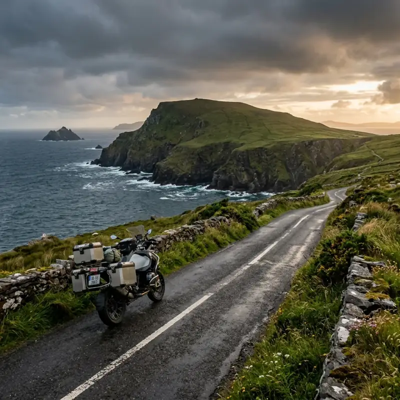
Ireland’s west coast does not do consistent. You can leave a campsite in Kerry under a flat grey sky, climb a pass into bright sun within twenty minutes, and be riding through a rain front off the Atlantic by lunchtime — all on the same road, the same morning. The Wild Atlantic Way is one of the great coastal motorcycle routes in Europe, and it asks for the same thing Scotland asks for: honest gear, an unhurried plan, and a willingness to let the weather decide the day.
It also happens to be the route Ireland built specifically to be ridden slowly. Launched in 2014, the Wild Atlantic Way stitches together roughly 2,500 km of coast road through nine counties, from Kinsale in County Cork up to the Inishowen Peninsula in Donegal. It’s not one road. It’s a brown-signed thread linking peninsulas, passes, fishing villages and several hundred bays, and it’s a natural companion to Scotland’s North Coast 500 for any rider working through the great roads of the British Isles.
Wild Atlantic Way vs NC500: Which Should You Ride?
If you’re choosing between Ireland’s west coast and Scotland’s NC500, it comes down to character rather than quality — both are exceptional. The NC500 is a tighter 830 km loop with starker, more mountainous Highland drama and the single dramatic hit of the Bealach na Bà. The Wild Atlantic Way is far longer, gentler in places, and more about the rhythm of peninsula after peninsula than one knockout pass.
Riders who’ve done both tend to agree on the practical differences. The Wild Atlantic Way usually works out cheaper and quieter, with less of the motorhome congestion that clogs the NC500’s single-track in peak summer — though the Ring of Kerry is the one stretch that does get busy. Scotland edges it on raw mountain spectacle; Ireland edges it on warmth, on the number of quiet bays you can drop down to, and on the friendliness that everyone who rides it mentions. If you want one sentence: ride Scotland for the mountains, ride Ireland for the coast and the welcome.
The Route at a Glance: Kinsale to Malin Head
The official route is divided into 14 waymarked stages. You don’t ride them as rigid days. Most riders group them by peninsula. But they’re a useful frame for the whole coast, here ordered south to north:
| Section | Roughly | What You’ll Remember |
|---|---|---|
| Kinsale → Beara Peninsula | 2 days | West Cork harbours, Sheep’s Head, Healy Pass |
| Ring of Kerry (Iveragh) | 1–2 days | Coastal corniches, Cahersiveen, Valentia Island |
| Dingle Peninsula | 1 day | Slea Head Drive and Conor Pass |
| Clare: Loop Head → the Burren | 1–2 days | Shannon ferry, Cliffs of Moher, Fanore |
| Connemara → Achill | 2 days | Sky Road, the bog roads, Keem Bay |
| Donegal → Inishowen | 2–3 days | Slieve League, Fanad Head, Malin Head |
Total: roughly 2,500 km of waymarked coast, though you’ll add plenty on top with detours and dead-end peninsulas, and the dead ends are often the best part. Treat the distances as a guide, not a schedule; the west coast rarely lets you average what the map suggests.
South to North or North to South?
The route is officially numbered north to south, starting at Muff on the Inishowen Peninsula in Donegal and finishing at Kinsale in Cork. Plenty of riders flip it.
Going south to north keeps the Atlantic on your left, which is the easier side to take in as the rider, and it saves the wild, empty drama of the Donegal headlands — Slieve League, Fanad, Malin Head — for the finish, when you’ve found your rhythm. Going north to south follows the official numbering and the brown signs more naturally, and works well if you’re arriving via Northern Ireland.
Neither is wrong. The real mistake isn’t direction. It’s trying to ride the whole 2,500 km in one direction in too few days and seeing the road without ever seeing the place.
The Signature Roads You Came For
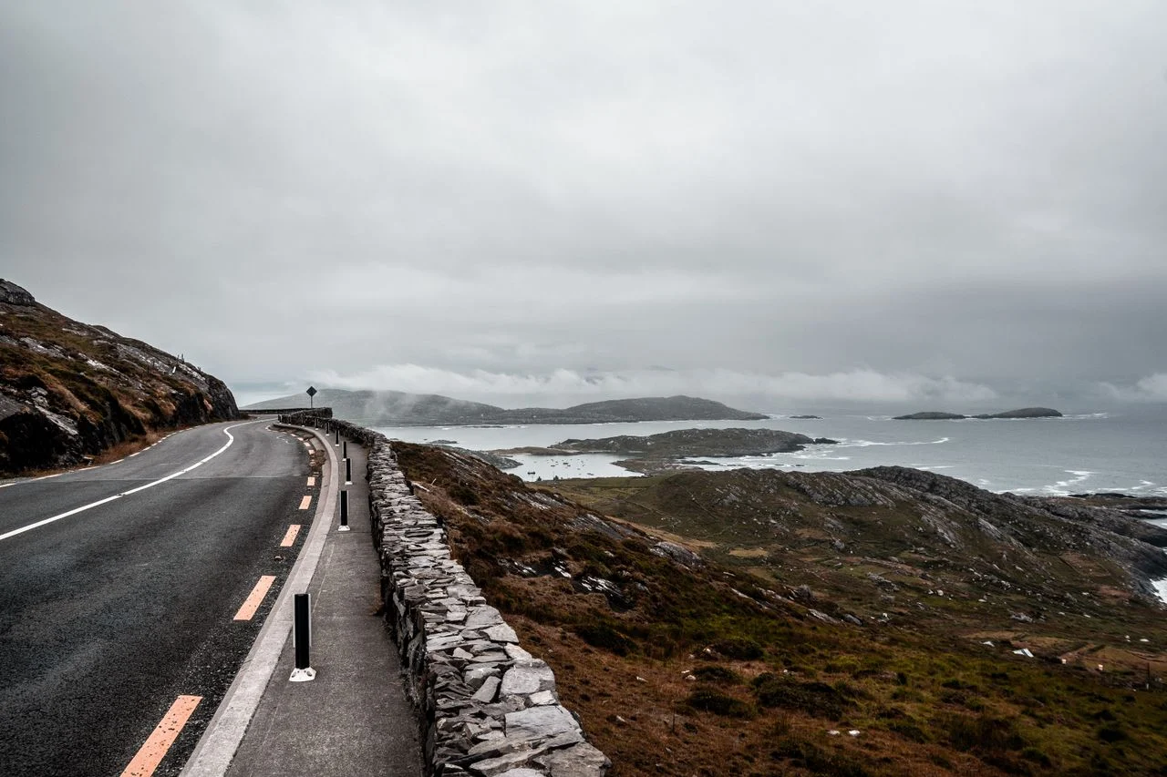
The Wild Atlantic Way isn’t a sequence of famous passes the way an Alpine route is. Its best riding is concentrated in the southern peninsulas, where a handful of roads are worth planning the whole trip around.
Healy Pass: Beara’s Hairpin Staircase
The R574 over Healy Pass is the finest stretch of tarmac in West Cork. It’s a 12 km serpentine climbing to 334 m across the Caha Mountains, from Adrigole on the Cork side to Lauragh in Kerry, with a relentless run of hairpins and gradients touching 18%. It’s narrow, but unlike the Ring of Kerry it carries very little traffic. Most tour buses never find it. So you get the switchbacks, the view down to Bantry Bay, and the quiet to enjoy both. The Beara Peninsula it crosses is the locals’ favourite, and the one most visitors skip.
Slea Head Drive: The Dingle Edge of Europe
Slea Head Drive loops the western tip of the Dingle Peninsula, and parts of it are single-lane road clinging to the cliff edge above the Atlantic, looking out at the Blasket Islands. Ride it clockwise. The locals and every guide say the same. So you’re on the inside of the narrowest sections and not meeting tour coaches head-on in summer. This is as far west as Europe’s road network really goes, and on a clear evening it’s one of the most atmospheric hours of riding on the whole coast.
Conor Pass: Ireland’s Highest Road
The R560 over Conor Pass is the highest surfaced mountain road in Ireland, topping out at 456 m between Dingle town and Brandon Bay. It’s spectacular and demanding: long stretches are a single twisty lane shared in both directions, with rock on one side and a drop on the other, so a face-to-face meeting can mean someone reversing to a passing place. Ride it early or late to dodge the worst of the traffic, take it slowly, and stop at the top. The view back over the corrie lakes and out to the bay is the reason it’s on every Dingle itinerary.
Sheep’s Head, Connemara and the Northern Headlands
Beyond the headline three, the quiet corners are where the route earns its name. Sheep’s Head, the slim peninsula near Bantry, is one of the most underexplored roads in the south — narrow, bendy, and empty. Up in Connemara, the Sky Road loop out of Clifden hangs over the islands and the open Atlantic. And in Donegal, the run out to Slieve League — sea cliffs nearly three times the height of the more famous Cliffs of Moher, and far less commercial — plus the Gap of Mamore on Inishowen and the lighthouse road to Fanad Head, give the north a wild, end-of-the-map feel that the busier south can’t match.
A Suggested Itinerary: 7, 10 or 14 Days
There’s no single right plan, but these three shapes cover how most riders tackle it.
7 days. The southern half, done properly. Start in Cork, ride West Cork and Beara (Healy Pass), the Ring of Kerry, Dingle (Slea Head and Conor Pass) and finish in Clare at the Cliffs of Moher. This is the densest, best riding on the route, and a week is enough to enjoy it rather than rush the whole coast.
10 days — Cork to Connemara. The southern peninsulas plus Clare’s Loop Head and the Burren, the Shannon ferry, and on into Connemara and the Sky Road, with a rest day built in around Galway. This is the most popular length and arguably the sweet spot.
14 days to 3 weeks. The full coast. Everything above plus Mayo, Achill Island’s Keem Bay, and the long, wild run through Donegal to Malin Head. If you have the time, this is the trip the route was designed for. Riders who’ve done it almost universally say they wish they’d allowed more days, not fewer.
Camping and the Bays
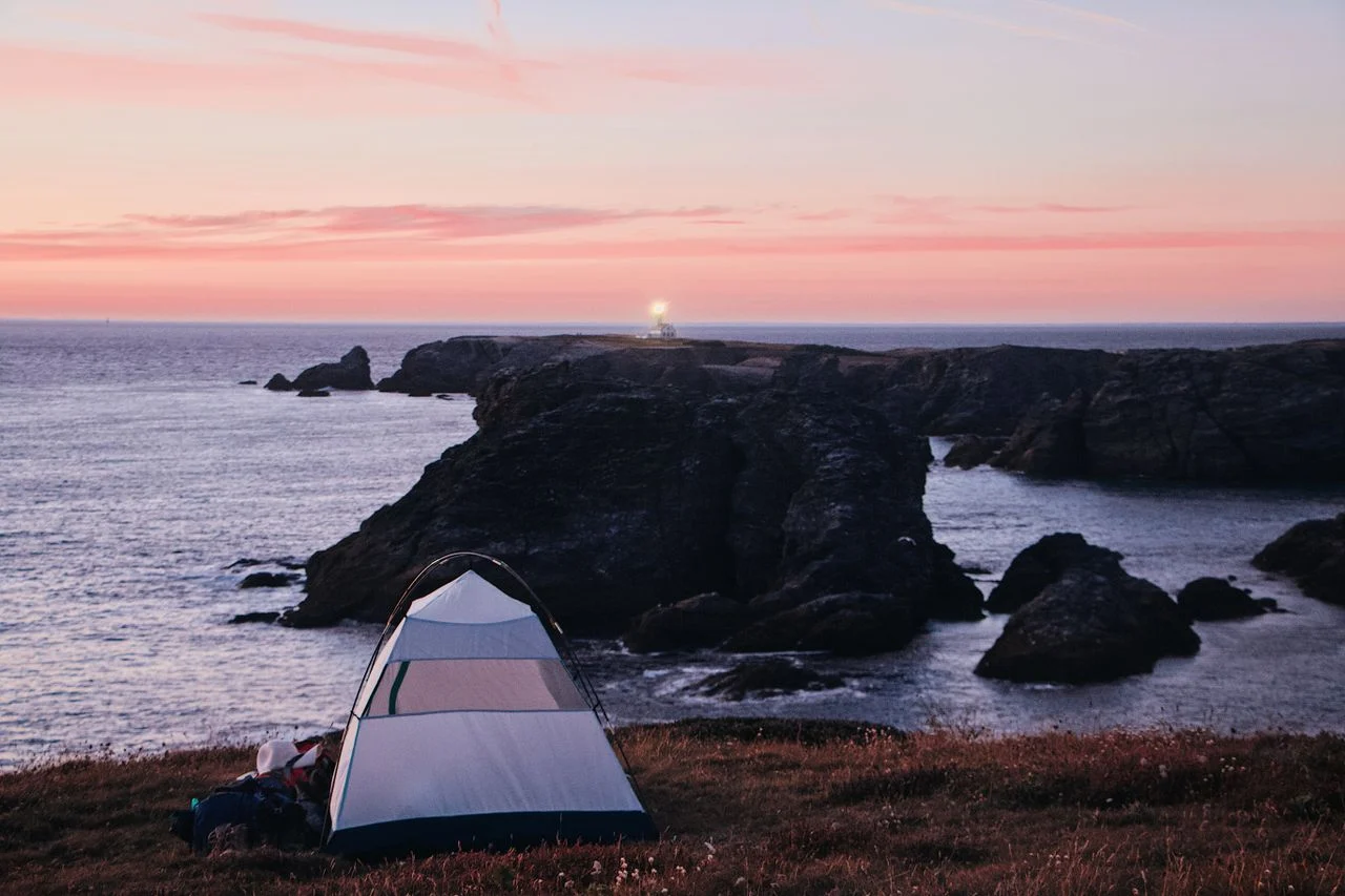
The west coast has one of the densest networks of small, friendly, often beachside campsites anywhere in Europe, and for a touring rider, they’re the backbone of the trip. A few that come up again and again, ordered roughly south to north:
| Campsite | Where | Why riders rate it |
|---|---|---|
| Glengarriff Caravan & Camping | Beara, West Cork | Ideal base for Healy Pass and the Beara loop |
| Mannix Point (Mortimer’s) | Cahersiveen, Ring of Kerry | Award-winning, on the water; turf fire in the campers’ room |
| Nagles Camping | Doolin, Clare | On Doolin Pier with the Cliffs of Moher in view from the tent |
| Clifden Eco Beach | Connemara | Coastal site almost on the water, after the Sky Road |
| Achill Sea Caves | Achill Island, Mayo | Beachfront on Dugort, near Keem Bay |
| Boyle’s Caravan Park | Portnoo, Donegal | Dune camping near Slieve League |
| Knockalla | Fanad, Donegal | Sea views and the Fanad Head lighthouse drive |
Mannix Point in Cahersiveen is the one to plan a night around. It sits on 500 m of waterfront on the Ring of Kerry, has collected more than a dozen national and international awards, and its campers’ sitting room — turf fire, kitchen, the odd impromptu music session — is exactly the kind of place a wet day on the bike makes you grateful for. Facilities are spotless and showers are a couple of euro.
For more on the kit side of coastal camping, the complete adventure motorcycle camping guide and the gear checklist cover what to actually carry.
Wild Camping in Ireland: The Legal Reality
Ireland does not have Scotland’s legal right to roam. Strictly speaking, wild camping anywhere requires the landowner’s permission, and that goes double for private farmland, military ground and utility land, where you can be moved on or fined.
In practice, discreet wild camping is widely tolerated along the remote stretches of the west coast, and experienced riders do it regularly. The unwritten rules are simple: arrive late, leave early, pitch one night only, stay well away from houses and farmland, take everything out, and leave no trace. Many of the single-track lanes running off the route lead down to beaches and quiet headlands where a small tent for a night goes unremarked. Known tolerated spots include the dunes at Fanore in Clare (though access there is partly restricted by the county council, so check the signs), Inch Beach and the Dunquin/Ventry area on Dingle.
The most reliable and most Irish option, though, is to knock and ask. A farmer will often wave you onto a field for a night, and you’ll usually get a weather forecast and directions thrown in. For the wider country-by-country picture, see the Europe wild-camping legal guide.
Getting Your Bike to Ireland
For riders coming from Britain or the Continent, the bike crosses by ferry. The main options:
- Holyhead → Dublin (Stena Line): the workhorse crossing, about 3 hours 15 minutes, up to eight sailings a day. The quickest way over from the UK mainland.
- Pembroke → Rosslare (Irish Ferries): around 4 hours into the south-east, with a motorbike fare typically about €45 / £40 — handy if you want to start in Cork and ride the route south to north.
- Cherbourg or Dunkirk → Rosslare (Irish Ferries / DFDS): the direct routes from France for riders coming from the Continent without the UK land bridge, run as overnight crossings with cabins.
From whichever port, it’s a half-day ride to the southern start at Kinsale or the Cliffs of Moher. If you’re combining it with a wider trip, the UK to Spain ferry guide covers the logistics of the longer crossings in the same way.
The Shannon Ferry Shortcut
There’s one ferry on the route itself worth knowing about. The Killimer–Tarbert car ferry crosses the Shannon Estuary between Clare and Kerry in about 20 minutes, saving a long inland detour around through Limerick. It’s the only vehicle ferry on the main spine of the Wild Atlantic Way, runs roughly hourly through the day, and a motorbike with rider costs around €11.70 single or €18 return (a little cheaper booked online; check current fares before you go). It’s a small thing, but on a route this long it’s both a genuine shortcut and a pleasant twenty-minute break with the engine off.
Weather, Hazards and the Best Time to Ride
The west coast of Ireland is wet and it is windy, and no amount of planning changes that — only your gear and your attitude do. Late March to mid-June and September to mid-November are the best windows: thinner traffic, lower prices, and a real chance of dry, clear days. July and August bring the longest daylight and the warmest temperatures, but also the tour buses on Kerry and Dingle, higher prices, and no guarantee of staying dry.
The hazards are the ordinary hazards of a rural coast, and worth respecting:
- Narrow, bankless single-track with blind bends, gravel wash, potholes and water run-off
- Animals and farm traffic — sheep, cattle being moved, slow tractors and milk tankers
- Exposed headland wind, which on the peninsulas can be strong enough to be dangerous, and in winter storms can shut exposed roads for a day or two
- Sudden rain fronts off the Atlantic that arrive faster than any forecast promised
Plan modest distances — 200 to 300 km is a full day here, and treat genuinely waterproof gear as non-negotiable rather than optional.
Packing for the Wild Atlantic Way
The short list that handles most of what the route throws at you:
- Fully waterproof jacket and trousers — sealed seams, not “water-resistant” (already wearing)
- Offline maps downloaded — phone signal drops on the remote peninsulas
- Tyres with good wet grip and a plug kit — wet roads and the odd gravel patch
- Layers for four seasons. It can be cold and wet up on Conor Pass even in summer
- A midge net if you’re camping near water in still, warm weather
Waterproofing is the thing riders most often get wrong. A textile suit that’s merely “water-resistant” wets out within an hour of real Irish rain and leaves you riding in cold, damp insulation. Proper sealed-seam waterproofs — a dedicated adventure touring jacket and trousers, or a one-piece oversuit — are what make the difference between a wet day you enjoy and one you endure. Pair them with waterproof boots and you can ride through almost anything the Atlantic sends.
Disclosure: some links below are affiliate links. If you buy through them we may earn a small commission at no extra cost to you.
Check Waterproof Touring Gear on Amazon →
Related Guides
For where this coast sits among Europe’s other great rides — the Alps, the Pyrenees, the fjords and the TET — see our ultimate Europe adventure motorcycle routes guide. For the Scottish sibling route, see the North Coast 500 motorcycle guide. For the legal detail on pitching a tent across the Continent, see the Europe wild-camping legal guide. And to plan the trip from the ground up — budget, packing and route logistics; start with long-distance trip planning checklist.
Disclosure: Some links in this article are affiliate links. If you buy gear through them, we may earn a small commission at no extra cost to you.
Frequently Asked Questions
How many days do you need to ride the Wild Atlantic Way?
Seven days is the realistic minimum to ride the spine without rushing, ten days lets you actually stop, and two to three weeks is what the route deserves if you have the time. The headline figure — 2,500 km — sounds like a four-day blast, but it isn't. The west coast is single-track roads, blind bends, peninsulas that double back on themselves, and weather that forces pauses. Most riders cover 200–300 km a day here, not 500. If you only have a week, ride the southern half (Cork, Kerry and Clare) properly rather than skimming the whole thing.
Is wild camping legal on the Wild Atlantic Way?
Not as a right — Ireland has no equivalent of Scotland's right to roam, so technically you need the landowner's permission to pitch anywhere. In practice, discreet one-night wild camping is widely tolerated along the west coast if you arrive late, leave at dawn, stay well away from houses and farmland, and follow leave-no-trace. The safest and most Irish approach is simply to ask: most farmers will happily let you camp a night if you knock and ask. There's also a dense network of cheap, friendly coastal campsites, several of them right on the beach, which is what most touring riders actually use.
Which direction should you ride the Wild Atlantic Way?
The official route is numbered north to south, from Muff on the Inishowen Peninsula down to Kinsale in Cork. Many riders prefer to ride it south to north instead, because that keeps the sea on your left — the easier side to glance at as the rider — and lets the scenery build toward the dramatic Donegal headlands at the end. Either works. What matters more than direction is not trying to do it in one direction in too few days.
What's the best time of year to ride it?
Late March to mid-June and September to mid-November are the sweet spots: lighter traffic, lower prices, and a real chance of dry spells. July and August are warmer and have the longest daylight, but the Ring of Kerry and Dingle clog with tour buses and prices climb — and it can still rain for days. Whenever you go, the west coast of Ireland will give you four seasons in a day, so the plan is to chase the dry weather rather than stick rigidly to a schedule.
Do you need an adventure bike for the Wild Atlantic Way?
No. It's almost entirely sealed road, so any bike that's comfortable for long days works — a touring bike, a naked, a middleweight adventure bike or even a small-capacity machine. A lighter bike is actually an advantage on the tightest single-track sections like Conor Pass and Slea Head Drive, where you may have to stop, reverse, or squeeze past oncoming cars. What matters far more than the bike is genuinely waterproof gear and tyres with good wet grip.