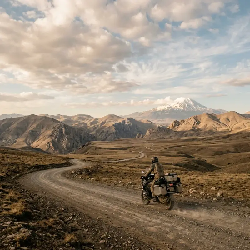
The west of Turkey is the coast you’ve seen in photos. The east is the country almost nobody rides — a high, dry, enormous plateau where the towns are far apart, the mountains are bigger than anything on the coast, and the history goes back further than you can quite get your head around. Plenty of riders do the Aegean and the Mediterranean half a dozen times before they finally point the bike east from Cappadocia — and the ones who go east never really shut up about it afterwards.
This is the route worth having in hand before that first trip east: a working eastern Anatolia motorcycle route that loops from Cappadocia out to the far east and back, taking in the stone gods on Mount Nemrut at sunrise, the island church on Lake Van, Mount Ararat looming over the Iranian border at Doğubayazıt, the ghost city of Ani on the Armenian frontier, and — if you’ve got the bike and the nerve. The legendary Dark Canyon stone road at Kemaliye on the way home. Seven days, around 2,600 kilometres with the ride home, and a side of Turkey that makes the coast feel almost crowded.
It picks up naturally from the Cappadocia motorcycle route, which is the obvious western anchor and warm-up before you commit to the long roads east.
Why Ride the East
Everything is bigger out east. The plateau runs at 1,500 to 2,000 meters before you even start climbing, the sky is enormous, and the distances between towns would swallow a coastal day whole. The vegetation thins to grassland and bare rock, the air gets cold the moment the sun drops, and the riding becomes about the road itself — long, empty, well-surfaced highways with mountains on the horizon for hours at a time.
It’s also the oldest part of the country to travel through. The colossal heads on Nemrut were carved for a king who wanted to be remembered as a god in the first century BC. Akdamar’s Armenian church is a thousand years old. Ani was a city of a hundred thousand people on the Silk Road before it was abandoned. You ride between these places across a landscape that has barely changed, through villages where a foreign motorcycle still stops conversation, and you are fed tea and pressed for stories at every fuel stop.
If the coast is where you go to relax, the east is where you go to feel like you’ve actually travelled.
The Route at a Glance
| Day | Stage | Distance | Highlight |
|---|---|---|---|
| 1 | Cappadocia → Kahta (Nemrut base) | ~520 km | The long run east; Euphrates crossing |
| 2 | Nemrut sunrise → Tatvan | ~430 km | Stone gods at dawn; Lake Van shore |
| 3 | Tatvan → Akdamar → Van | ~160 km | Island church, lake road |
| 4 | Van → Muradiye → Doğubayazıt | ~190 km | İshak Paşa Sarayı, Mount Ararat |
| 5 | Doğubayazıt → Kars (Ani) | ~290 km | Ghost city on the Armenian border |
| 6 | Kars → Erzurum → Erzincan | ~395 km | High plateau riding |
| 7 | Erzincan → Kemaliye, then west | ~180 km + canyon, ~500 km home | The Dark Canyon stone road |
Total: roughly 2,600 km including the run home (distances are our routing estimates), with three long days (1, 2 and 6), a long ride back west from Kemaliye, and the rest broken up by the big sites. The optional Nemrut summit gravel and the Kemaliye stone road are the only non-tarmac sections.
Day 1: Cappadocia to Kahta (520 km)
The first day is a transit day, and there’s no way around it. The east starts a long way from anywhere. From Cappadocia, ride southeast through Kayseri and down toward Adıyaman, crossing the upper Euphrates on the way. The land flattens and dries, the traffic thins, and you settle into the rhythm of eastern distances: long straights, big skies, fuel stops where everyone wants to know where you’re from.
Base yourself in Kahta or, better, up in the village of Karadut on the mountain itself, which puts you within striking distance of the summit for the morning. This is purely a positioning day — get the kilometers done, eat well, and sleep early, because tomorrow starts before dawn.
Road notes: Good fast highway most of the way. Start with a full tank and ride efficiently. This is a distance day, not a sightseeing one. Fuel in Kayseri and Adıyaman.
Day 2: Mount Nemrut at Sunrise, then to Tatvan (430 km)
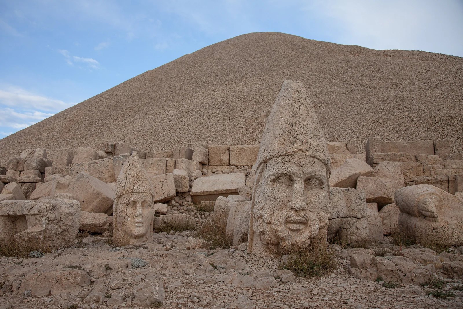
Up in the dark. The reason you slept on the mountain is to ride the last stretch to the Nemrut Dağı summit car park before first light, then walk the final path up to the eastern terrace for sunrise. At around 2,150 meters, the colossal stone heads of gods and the king Antiochus I sit toppled from their bodies, lit gold as the sun comes up over the plateau. It is, without exaggeration, one of the great sights of the country, and worth every cold, dark kilometer it takes to get there. The final approach road has a rough, partly unpaved section near the top; take it gently in the dark.
Back down the mountain, point east. The day runs across the plateau toward Tatvan on the western shore of Lake Van — a vast inland sea so big it has its own weather. The approach to the lake, dropping out of the hills to that impossible blue, is a moment. Overnight in Tatvan.
Road notes: Cold at altitude before dawn — gear up properly. The summit gravel is the only tricky bit and it’s short. Long plateau highway to Tatvan; fuel before the empty stretches.
Day 3: Tatvan to Akdamar and Van (160 km)
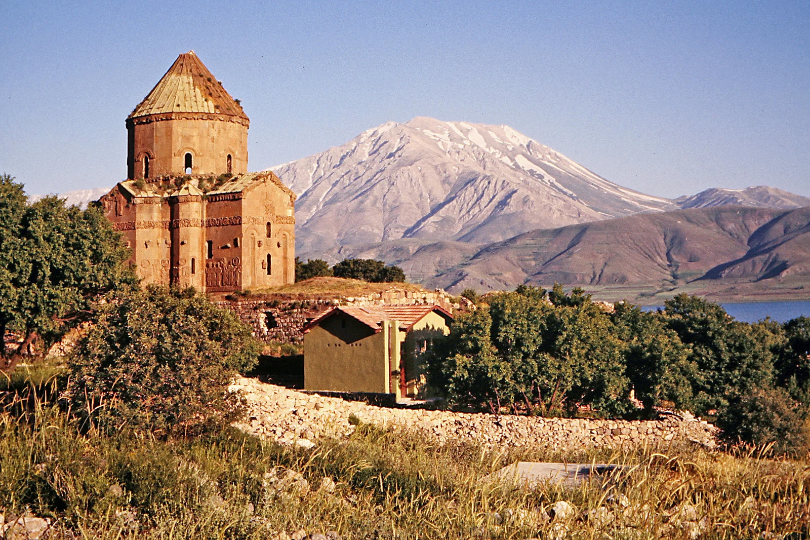
A shorter, gentler day along the southern shore of Lake Van. The lake road is one of the most relaxing rides on the route — calm water on one side, bare mountains on the other, and far less traffic than you’d expect for such a landmark.
The stop that makes the day is Akdamar Island. From the jetty near Gevaş, a short boat takes you across to the tenth-century Armenian Church of the Holy Cross, its exterior carved with biblical scenes, standing alone on a tiny island in that enormous blue lake. Leave the bike at the jetty, take the boat, give it an hour or two.
Continue along the shore into Van for the night — a lively university city famous for its breakfast culture (the Van kahvaltısı is a regional institution; have it before you leave). Van Castle above the old city is worth the climb at sunset.
Road notes: Easy lake-shore riding. Watch for slow trucks and the occasional pothole. Van has full services; fuel, food, a place to service the bike if you need it.
Day 4: Van to Doğubayazıt via Muradiye (190 km)
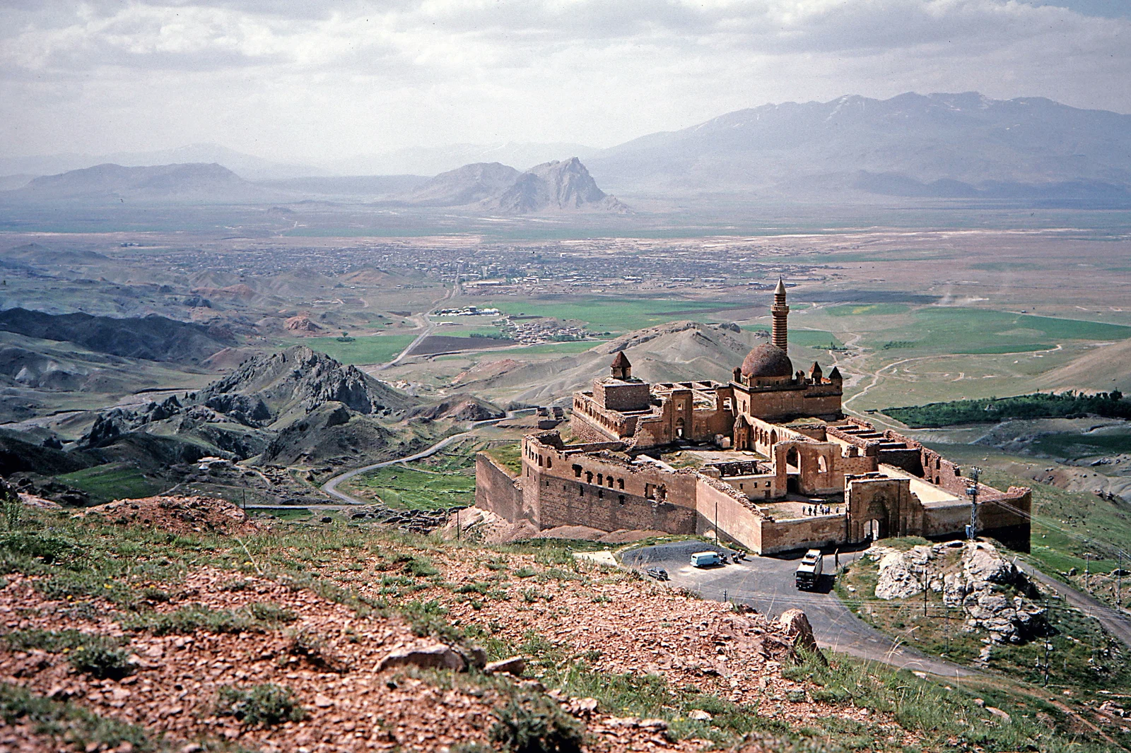
North from Van, the road climbs toward the great volcanic cones of the far east. Stop at the Muradiye Waterfall, a broad falls reached by a swaying footbridge, then carry on across the high country toward Doğubayazıt, the last town before the Iranian border at Gürbulak. The route crosses the Tendürek high ground at around 2,600 meters; exposed, cold, spectacular.
Doğubayazıt’s prize is the İshak Paşa Sarayı, a seventeenth-century palace of more than three hundred rooms perched on a rock terrace above the plain, one of the most beautiful pieces of architecture in the country and all the more striking for how remote it is. Above it all stands Mount Ararat — at 5,137 meters the highest mountain in Turkey, snow-capped year round, filling the entire eastern sky. Ride up to the palace in the late afternoon when the light is best and Ararat is clear.
Road notes: High, exposed and cold up top even in summer — carry a layer. Border zone awareness near Gürbulak. Fuel in Doğubayazıt.
Day 5: Doğubayazıt to Kars and Ani (290 km)
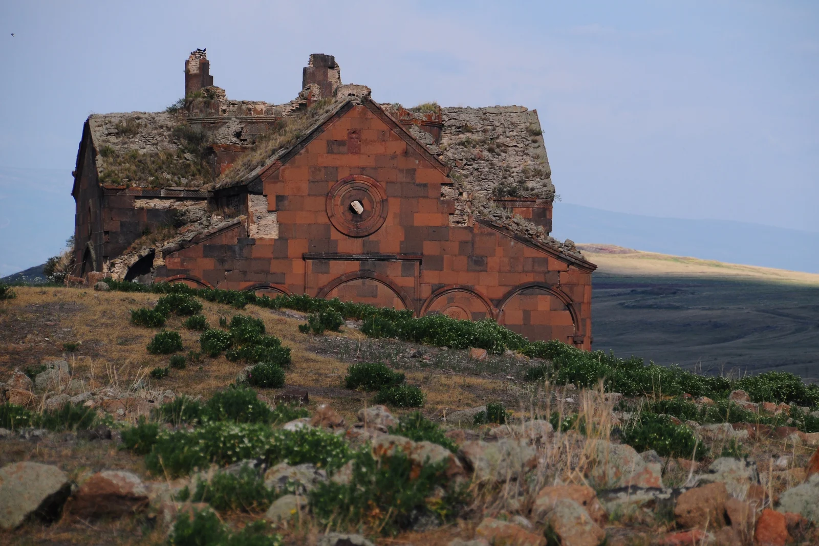
A big plateau day north and west to Kars, the handsome old garrison town with its Russian-era stone architecture. The riding is classic eastern Anatolia; long, empty, high, fast.
The reason to come is Ani, 45 km east of Kars right on the Armenian border: the ruins of a medieval Silk Road capital that once rivalled Constantinople, now a field of roofless churches and cathedrals scattered across the grassland above a river gorge that forms the closed frontier. It’s haunting and almost empty, and standing in the great cathedral with Armenia visible across the ravine is one of those moments the east specializes in. Ride out, walk the site, ride back to Kars for the night.
Road notes: Long empty legs — keep the tank topped. Photography is restricted right at the border; follow the signs. Kars has full services.
Day 6: Kars to Erzurum and Erzincan (395 km)
The long ride home begins. West from Kars across more high plateau to Erzurum. The big city of the east, with its Seljuk monuments and, if you’re here in winter, its ski slopes, and on toward Erzincan. This is the second of the two real distance days: high, fast, scenic in a stark way, and a chance to cover ground before the finale.
If you’re tired or the weather’s turned, Erzurum is a comfortable place to break the day instead and split this into two. Otherwise push on to Erzincan to set up for the Kemaliye stone road in the morning.
Road notes: Fast highway, high altitude, big distances. Fuel in Erzurum. Watch the weather. The high plateau can turn cold and wet fast even in summer.
Day 7: The Kemaliye Dark Canyon Stone Road (180 km + the canyon)
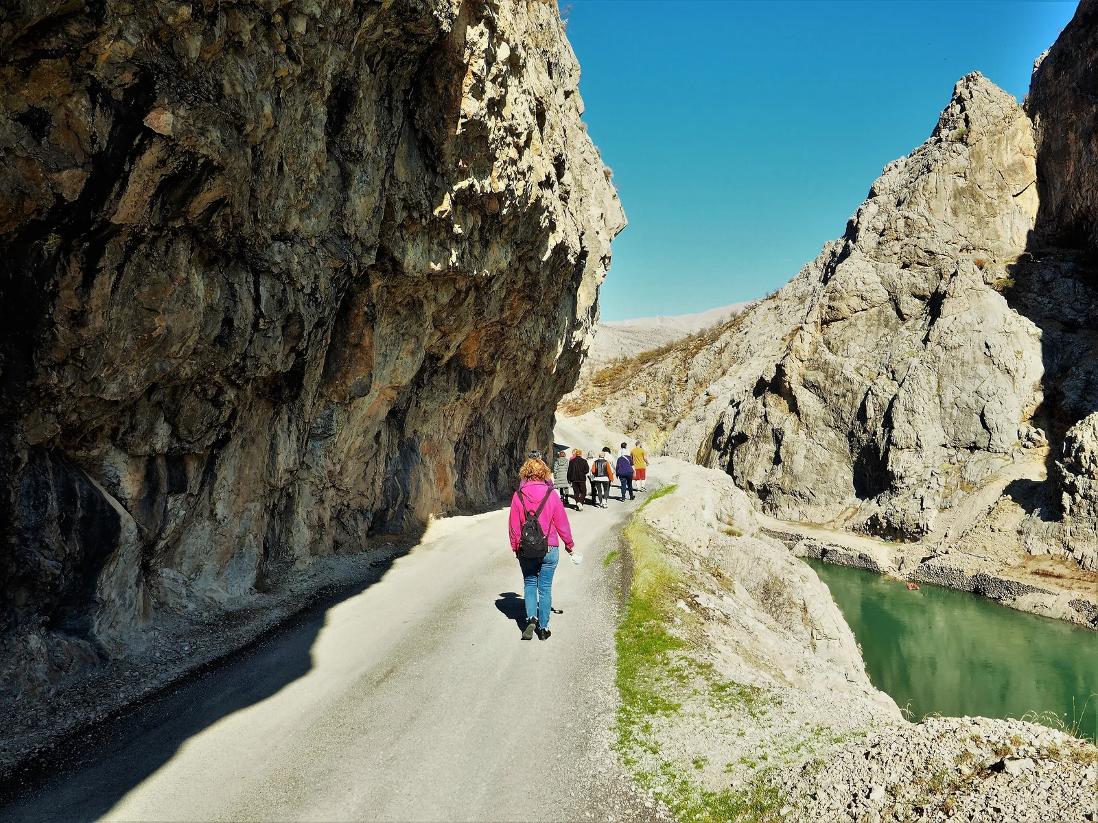
Save the most dramatic riding for last, and know your limits. The Karanlık Kanyon (Dark Canyon) near Kemaliye holds the Taş Yol, the Stone Road: a single-lane track hand-cut into the sheer rock wall of a deep gorge on the Euphrates, with tunnels punched through the cliff and a long drop to the river below and no guardrail to speak of. Villagers cut it by hand over more than a century, and it’s one of the most spectacular stretches of road anywhere in Turkey.
It is also genuinely exposed and not for nervous riders — narrow, rough in places, with sheer drops. If you’re confident and the conditions are dry, it’s the ride of the trip. If you’re loaded heavy, tired, or unsure, there’s no shame in admiring it from the safer viewpoints. For the skills this kind of riding asks for, the off-road riding tips for loaded adventure bikes guide is worth reading before you go.
From Kemaliye, the road turns west toward Sivas and the long run back to Cappadocia, about 500 km, closing the loop; most riders will want a night in Sivas rather than doing it in one go after the canyon. You’ll arrive back on the coast-bound highways a different rider than the one who left.
Road notes: The Stone Road is narrow, partly unpaved, with serious exposure — ride it dry, ride it sober, ride it slow. Skip it in rain. Fuel before the canyon; services are thin out here.
What the East Costs in Fuel (2026)
Turkey is cheap to ride and the east is no exception. As of mid-2026, unleaded 95 runs around ₺63 per litre nationally, with diesel a touch higher near ₺65. Prices track the lira, so check at the pump. But even with the long distances, fuel is a minor line in the budget out here.
A 2,500 km loop on a small 250 burns somewhere around 90 litres — roughly ₺5,500-5,700 of fuel for the entire week. On a thirstier adventure bike running 6 litres per 100 km you’d more than double that and it’s still modest by European standards. The thing to watch out east isn’t price, it’s availability: fill up in every town, and don’t let the tank drop below half on the long empty plateau legs between Doğubayazıt, Kars and Erzurum.
Packing Notes for the High East
Beyond standard touring kit, what the east specifically demands:
- A genuine warm layer — even in July, dawn on Nemrut and the high passes are cold (300 g)
- Rain gear; the high plateau makes its own weather and it turns fast
- Enough fuel range to cover 200 km between fills with margin
- Cash in lira — cards aren’t universal in small eastern towns
- Offline maps for the eastern provinces; signal is patchy out here
- A real tool kit and a tyre repair kit — help is a long way off
If you’re camping rather than using town pensions, the high cold nights make a proper sleeping setup non-negotiable — see the compact sleeping pads and tent guides for what handles altitude.
Best Season and Weather
Mid-June to August: the reliable window. The passes are clear, the days are warm to hot on the plateau, and the high country is at its best. Nights stay cold at altitude year round.
September: arguably the sweetest time — cooler riding, clear roads, thinner crowds at the sites, golden light on the plateau. Watch for the first high-pass snow toward month’s end.
Late May / early June: possible, but snow can still block the highest passes and Nemrut’s summit. Check before you commit to the high sections.
October to May: effectively closed. Heavy snow shuts the passes, nights are brutal, and many high roads become impassable. The east is a summer route, full stop.
Related Guides
- For where this east-country leg sits in a full Turkey trip — how much time each region wants, and the seasons that decide the order — see our ultimate Turkey motorcycle tour guide.
- It begins where the Cappadocia motorcycle route leaves off; ride them back to back.
- For the off-pavement skills the Nemrut summit and Kemaliye stone road ask for, see off-road riding tips for loaded adventure bikes.
- To carry on north to the Black Sea instead of looping back, pick up the Black Sea & Kaçkar route or continue from the Black Sea into Georgia.
- For the trailside spares that matter when help is hours away, see the field tool kit checklist.
This guide is compiled from published route information, site and park authority sources and rider reports. Some links in this article are affiliate links — if you buy gear through them, we may earn a small commission at no extra cost to you.
Frequently Asked Questions
When is the eastern Anatolia route actually rideable?
Mid-June to late September is the safe window. The east sits at 1,500-2,000 m average altitude, and the high points are far higher — Nemrut's summit is around 2,150 m, the Tendürek pass near Doğubayazıt is roughly 2,600 m, and snow lingers on the high passes into late May. Outside June-September you risk snow on the passes and bitter nights even when the days are warm. July and August are the most reliable for clear roads; September gives you cooler riding and thinner crowds. November to April, much of this route is effectively closed by snow.
Can I ride this on a small or mid-size bike?
Yes. Riders do it on bikes as small as a 250, and the thing to watch is wind and distance, not the terrain — the route is paved the whole way if you skip the optional Kemaliye stone road and the Nemrut summit gravel. The east is about big distances at altitude, so a comfortable seat and decent fuel range matter more than power. A mid-size adventure bike is the ideal tool; a small bike does it on grit and patience; a heavy tourer is fine on the tarmac but a handful on the rough optional sections.
How bad are the fuel gaps out east?
Bigger than on the coast, but manageable if you plan. Towns like Kahta, Tatvan, Van, Doğubayazıt, Kars and Erzurum all have plenty of stations. The gaps open up on the high plateau stretches between them — plan on filling up in every town and not letting the tank drop below half on the long empty legs, especially Doğubayazıt to Kars and anything involving a detour up to Nemrut or out to Kemaliye. Carry the range to cover 200 km between fills and you'll never be caught out.
Is it safe to ride in eastern Turkey?
For ordinary touring on this route, yes. The east is poorer and emptier than the west, the roads are longer between services, and you'll draw a lot of friendly curiosity — but the hospitality is genuine and overwhelming, and tourists on bikes are welcomed warmly. Ride conservatively, watch for livestock and unlit vehicles after dark, carry cash since cards aren't universal in small places, and check current local advice before riding right up to the Iranian or Armenian border zones. The practical risks here are weather, altitude and distance, not people.
How long do I need for the whole loop?
Seven riding days, plus a day or so for the long ride home from Kemaliye, is comfortable for the loop described here, covering roughly 2,600 km in all. You could compress the highlights into five hard days, but the east punishes a rushed schedule — the distances are long, the altitude tires you, and the whole point is the empty road and the sites along it. Give it a week, or split off the Kemaliye finale and make it a tighter five-day out-and-back to Van.